MyTopo
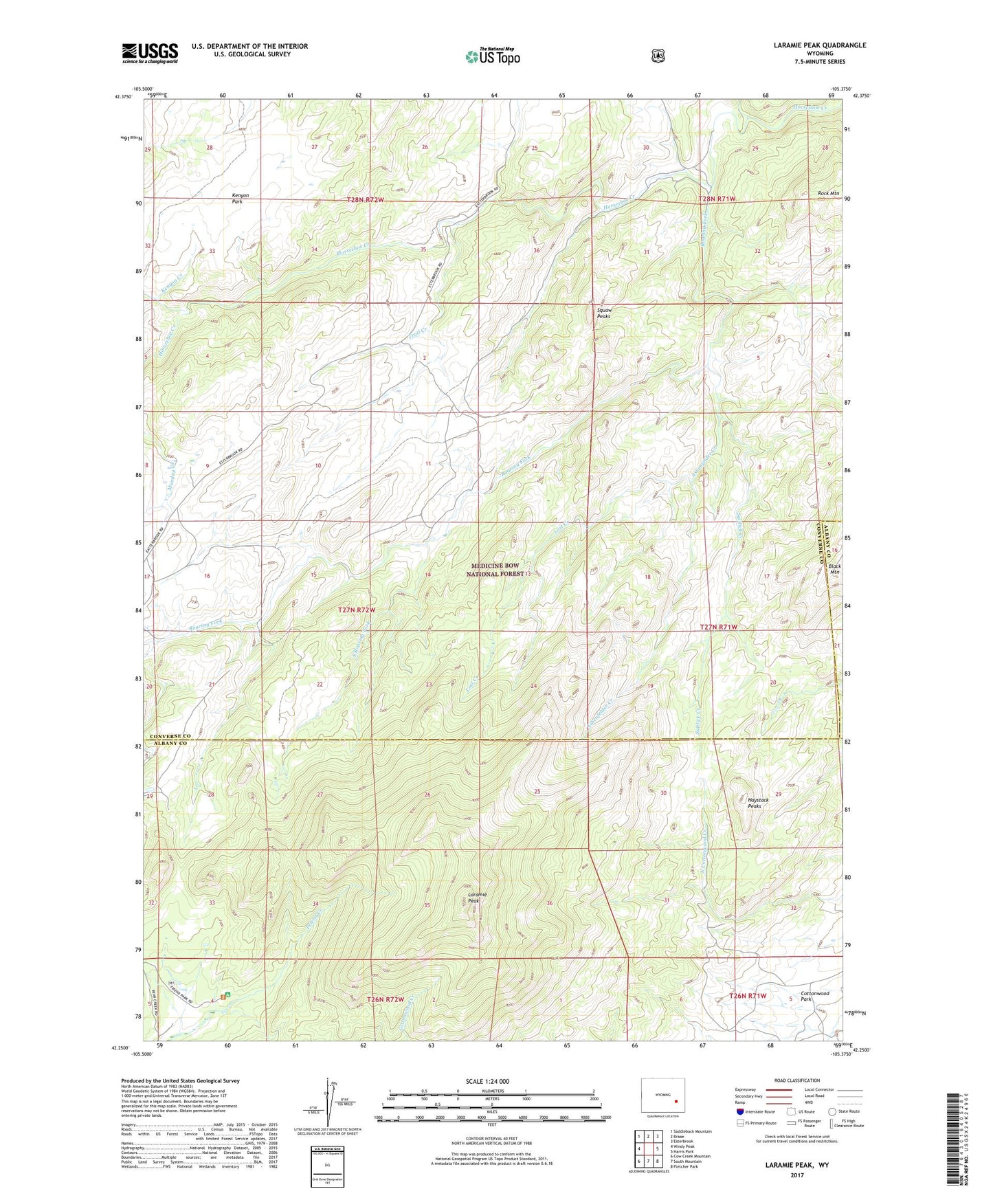
Laramie Peak Wyoming US Topo Map
Couldn't load pickup availability
Also explore the Laramie Peak Forest Service Topo of this same quad for updated USFS data
2023 topographic map quadrangle Laramie Peak in the state of Wyoming. Scale: 1:24000. Based on the newly updated USGS 7.5' US Topo map series, this map is in the following counties: Converse, Albany. The map contains contour data, water features, and other items you are used to seeing on USGS maps, but also has updated roads and other features. This is the next generation of topographic maps. Printed on high-quality waterproof paper with UV fade-resistant inks.
Quads adjacent to this one:
West: Windy Peak
Northwest: Saddleback Mountain
North: Braae
Northeast: Esterbrook
East: Harris Park
Southeast: Fletcher Park
South: South Mountain
Southwest: Cow Creek Mountain
This map covers the same area as the classic USGS quad with code o42105c4.
Contains the following named places: Ashenfelder Creek, Atkinson Ranch, Black Mountain, Friend Park, Friend Park Campground, Hay Creek, Haystack Peaks, John Creek, Kenyon Creek, Kenyon Park, Laramie Peak, Lost Creek, Mary Cooper Creek, Pickerall Ranch, Pickerall School, Roaring Fork, Rock Mountain, Saltlick Creek, South Roaring Fork, Squaw Peaks, Sturgeon Ranch, Trail Creek