MyTopo
Crimson Dawn Wyoming US Topo Map
Couldn't load pickup availability
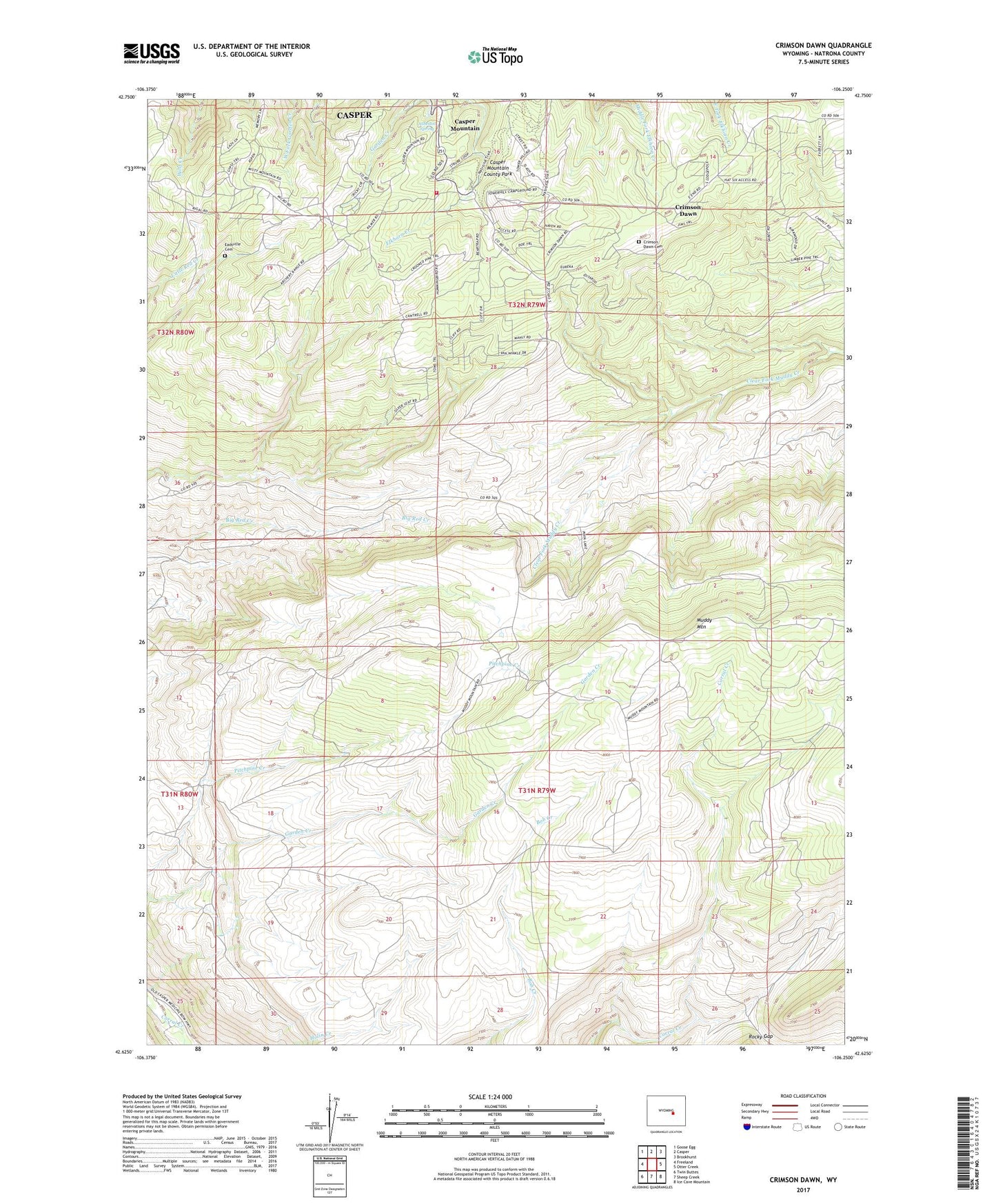
2021 topographic map quadrangle Crimson Dawn in the state of Wyoming. Scale: 1:24000. Based on the newly updated USGS 7.5' US Topo map series, this map is in the following counties: Natrona. The map contains contour data, water features, and other items you are used to seeing on USGS maps, but also has updated roads and other features. This is the next generation of topographic maps. Printed on high-quality waterproof paper with UV fade-resistant inks.
Quads adjacent to this one:
West: Freeland
Northwest: Goose Egg
North: Casper
Northeast: Brookhurst
East: Otter Creek
Southeast: Ice Cave Mountain
South: Sheep Creek
Southwest: Twin Buttes
This map covers the same area as the classic USGS quad with code o42106f3.
Contains the following named places: Asbestos Spring, Beartrap Meadow County Park, Big Red Creek Mine, Camp Sacajawea, Camp Wyoba, Casper Lions Camp, Casper Mountain, Casper Mountain Census Designated Place, Casper Mountain County Park, Casper Mountain Fire Department, Casper Mountain Mine, Cheney Cow Camp, Crimson Dawn, Crimson Dawn Cemetery, Eadsville, Eadsville Cemetery, Hogadon Basin Ski Area, KCSP-FM (Casper), KFNB-TV (Casper), KGWC-TV (Casper), KMGW-FM (Casper), Koch Deposit Number Three, KQLT-FM (Casper), KTRS-FM (Casper), KTWO-TV (Casper), Muddy Creek Mine, Rocky Gap