MyTopo
Daniel Wyoming US Topo Map
Couldn't load pickup availability
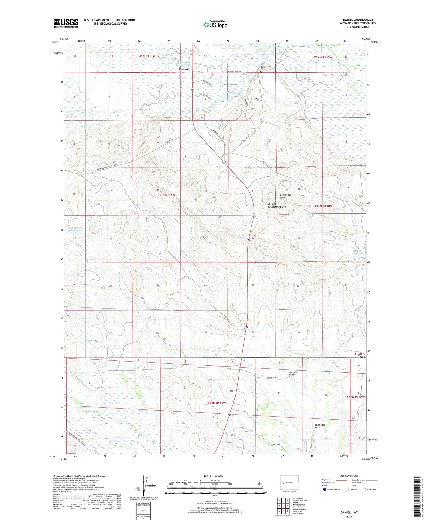
2021 topographic map quadrangle Daniel in the state of Wyoming. Scale: 1:24000. Based on the newly updated USGS 7.5' US Topo map series, this map is in the following counties: Sublette. The map contains contour data, water features, and other items you are used to seeing on USGS maps, but also has updated roads and other features. This is the next generation of topographic maps. Printed on high-quality waterproof paper with UV fade-resistant inks.
Quads adjacent to this one:
West: Onion Springs
Northwest: Webb Draw
North: Daniel Junction
Northeast: Cora
East: Mount Airy
Southeast: Mesa Spring
South: Ball Island
Southwest: Budd Reservoir
Contains the following named places: Brome Ditch, Daniel, Daniel Cemetery, Daniel Census Designated Place, Daniel Fire Battalion, Daniel Grindstone Butte, Daniel Post Office, Essex Ditch, Fear Ditch Reservoir, Green River Supply Canal, Hedin and Slate Ditch, Horse Creek, Lawrence Ditch, Onion Creek, Poole Ditch Number 2, Prairie Creek, Raven Reservoir, Ryegrass Reservoir, Soap Hole Basin, Soaphole Bridge, Todd Ditch, Travelute Reservoir