MyTopo
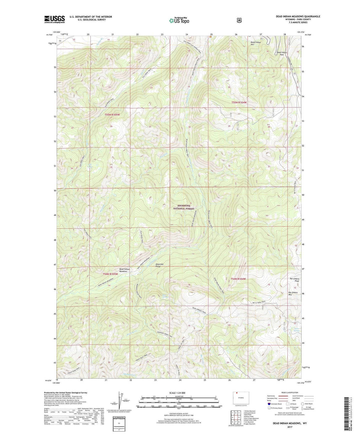
Dead Indian Meadows Wyoming US Topo Map
Couldn't load pickup availability
Also explore the Dead Indian Meadows Forest Service Topo of this same quad for updated USFS data
2021 topographic map quadrangle Dead Indian Meadows in the state of Wyoming. Scale: 1:24000. Based on the newly updated USGS 7.5' US Topo map series, this map is in the following counties: Park. The map contains contour data, water features, and other items you are used to seeing on USGS maps, but also has updated roads and other features. This is the next generation of topographic maps. Printed on high-quality waterproof paper with UV fade-resistant inks.
Quads adjacent to this one:
West: Elkhorn Peak
Northwest: Windy Mountain
North: Dillworth Bench
Northeast: Bald Peak
Southeast: Logan Mountain
South: Jim Mountain
Southwest: Dead Indian Peak
This map covers the same area as the classic USGS quad with code o44109f4.
Contains the following named places: Bear Springs, Dead Indian Meadows, Dead Indian Pass, Dry Fork, Elk Lakes, Morning Creek, Pearson Cabin, Spout Springs