MyTopo
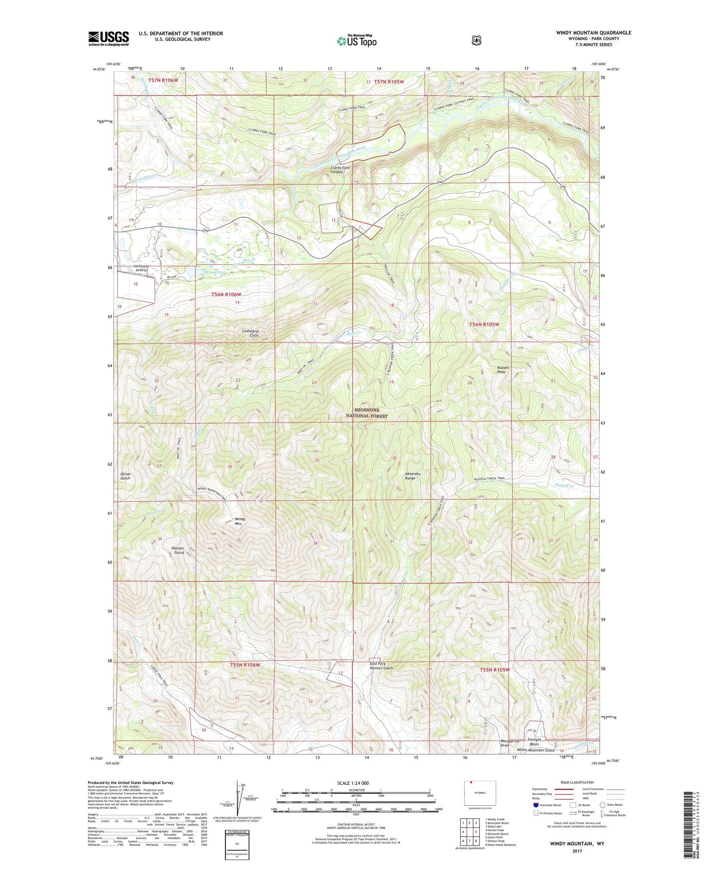
Windy Mountain Wyoming US Topo Map
Couldn't load pickup availability
Also explore the Windy Mountain Forest Service Topo of this same quad for updated USFS data
2021 topographic map quadrangle Windy Mountain in the state of Wyoming. Scale: 1:24000. Based on the newly updated USGS 7.5' US Topo map series, this map is in the following counties: Park. The map contains contour data, water features, and other items you are used to seeing on USGS maps, but also has updated roads and other features. This is the next generation of topographic maps. Printed on high-quality waterproof paper with UV fade-resistant inks.
Quads adjacent to this one:
West: Hunter Peak
Northwest: Muddy Creek
North: Beartooth Butte
Northeast: Deep Lake
East: Dillworth Bench
Southeast: Dead Indian Meadows
South: Elkhorn Peak
Southwest: Geers Point
This map covers the same area as the classic USGS quad with code o44109g5.
Contains the following named places: Beartooth Creek, Camp Creek Quarry, Canyon Creek, Cathedral Cliffs, Corral Creek, Crandall Creek, Deadman Creek, Dodd Ranch, East Fork Painter Gulch, K Bar Z Ranch, Lewis and Clark Trail, Luckinbill Airstrip, Oliver Gulch, Reef Creek, Reef Creek Campground, Reef Creek Trail, Rocky Ford, Russell Peak, Swamp Lake, Table Creek, White Mountain Gulch, Windy Mountain