MyTopo
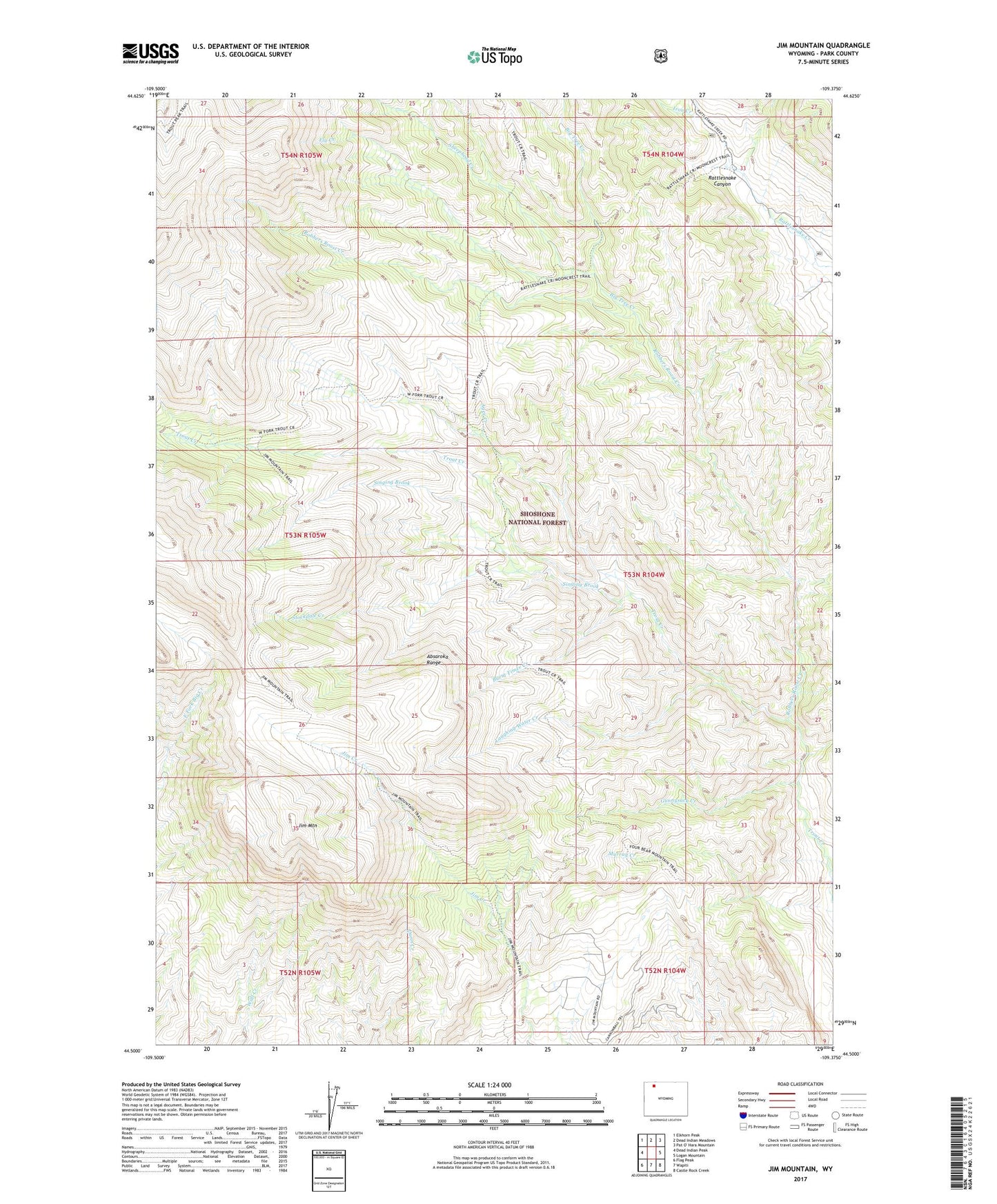
Jim Mountain Wyoming US Topo Map
Couldn't load pickup availability
Also explore the Jim Mountain Forest Service Topo of this same quad for updated USFS data
2021 topographic map quadrangle Jim Mountain in the state of Wyoming. Scale: 1:24000. Based on the newly updated USGS 7.5' US Topo map series, this map is in the following counties: Park. The map contains contour data, water features, and other items you are used to seeing on USGS maps, but also has updated roads and other features. This is the next generation of topographic maps. Printed on high-quality waterproof paper with UV fade-resistant inks.
Quads adjacent to this one:
West: Dead Indian Peak
Northwest: Elkhorn Peak
North: Dead Indian Meadows
East: Logan Mountain
Southeast: Castle Rock Creek
South: Wapiti
Southwest: Flag Peak
This map covers the same area as the classic USGS quad with code o44109e4.
Contains the following named places: Agee Creek, Big Tree Creek, Burnt Timer Creek, Fly Creek, Four Bear Ranch, Gunnysack Creek, Iron Creek, Jim Mountain, Laughing Water Creek, Mooncrest Ranch, Robbers Roost Cabin, Robbers Roost Creek, Sheephead Creek, Singing Brook, Stockdale Creek, Trout Creek Trail, Weber Creek, ZIP Code: 82450