MyTopo
Dead Indian Peak Wyoming US Topo Map
Couldn't load pickup availability
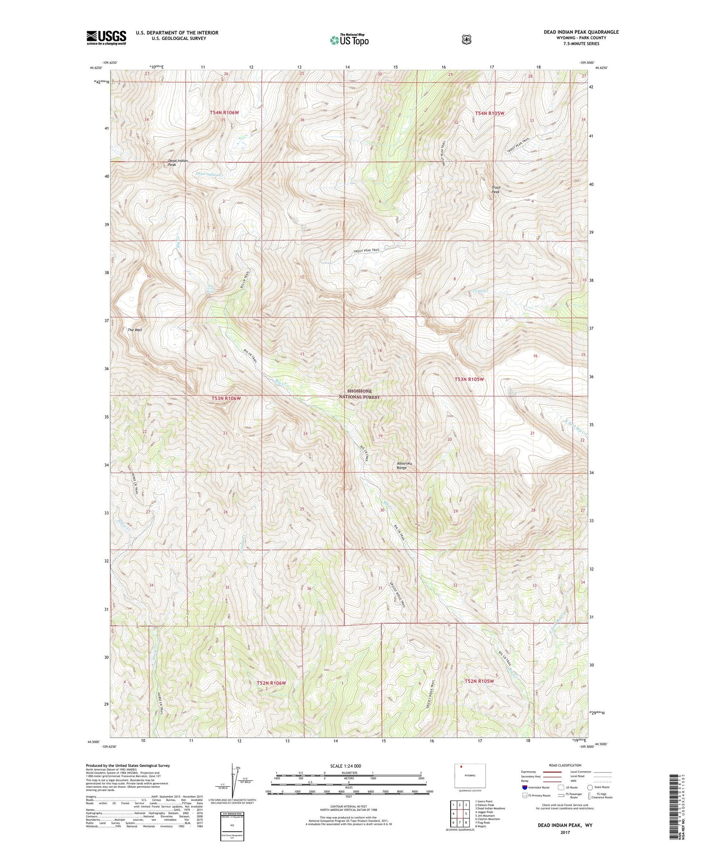
2021 topographic map quadrangle Dead Indian Peak in the state of Wyoming. Scale: 1:24000. Based on the newly updated USGS 7.5' US Topo map series, this map is in the following counties: Park. The map contains contour data, water features, and other items you are used to seeing on USGS maps, but also has updated roads and other features. This is the next generation of topographic maps. Printed on high-quality waterproof paper with UV fade-resistant inks.
Quads adjacent to this one:
West: Jaggar Peak
Northwest: Geers Point
North: Elkhorn Peak
Northeast: Dead Indian Meadows
East: Jim Mountain
Southeast: Wapiti
South: Flag Peak
Southwest: Clayton Mountain
Contains the following named places: Big Creek Falls, Cody Division, Dead Indian Peak, East Fork Big Creek, Park County, The Wall, Trout Peak