MyTopo
Del Monte Ridge Wyoming US Topo Map
Couldn't load pickup availability
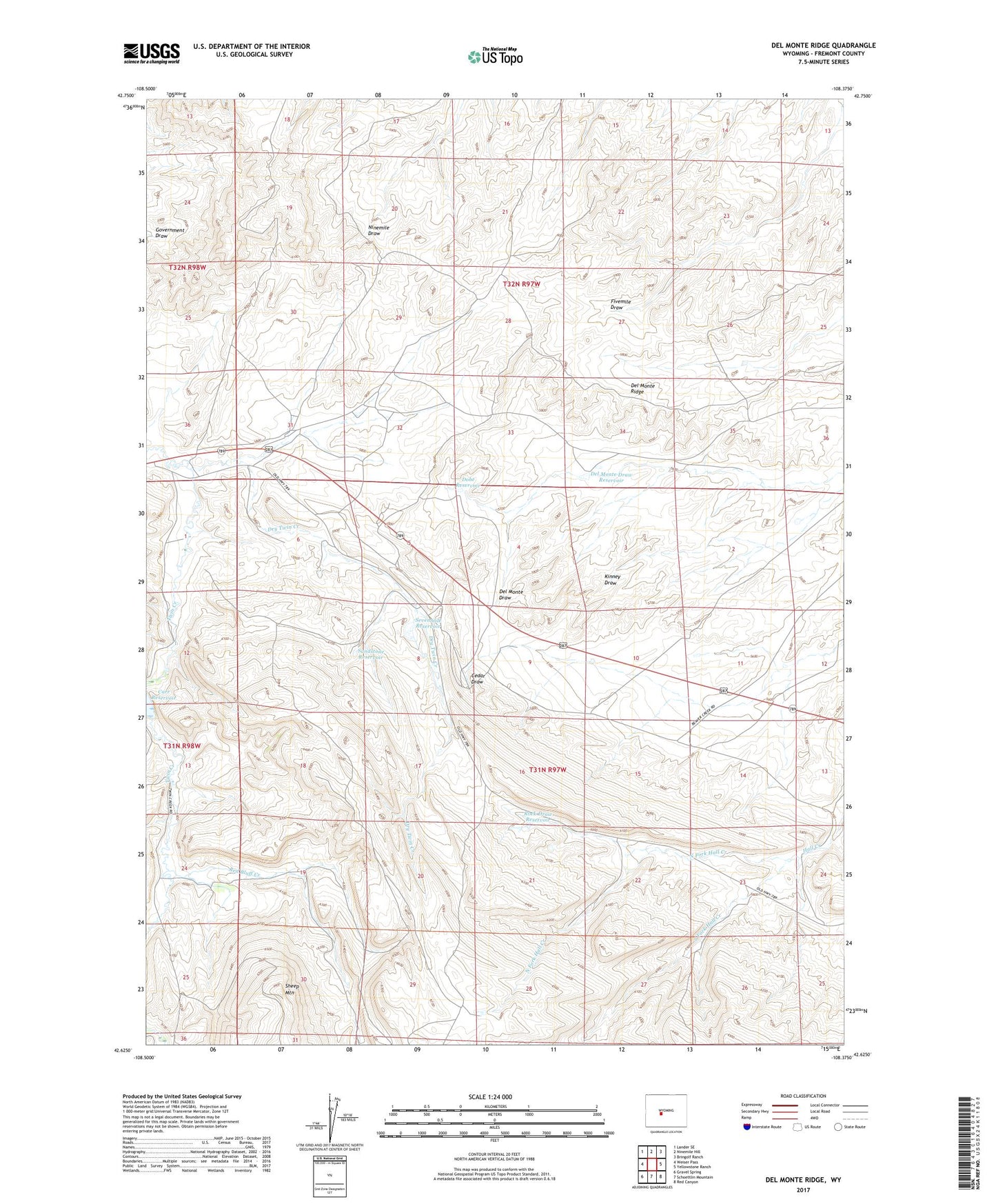
2021 topographic map quadrangle Del Monte Ridge in the state of Wyoming. Scale: 1:24000. Based on the newly updated USGS 7.5' US Topo map series, this map is in the following counties: Fremont. The map contains contour data, water features, and other items you are used to seeing on USGS maps, but also has updated roads and other features. This is the next generation of topographic maps. Printed on high-quality waterproof paper with UV fade-resistant inks.
Quads adjacent to this one:
West: Weiser Pass
Northwest: Lander SE
North: Ninemile Hill
Northeast: Bringolf Ranch
East: Yellowstone Ranch
Southeast: Red Canyon
South: Schoettlin Mountain
Southwest: Gravel Spring
This map covers the same area as the classic USGS quad with code o42108f4.
Contains the following named places: Carr Reservoir, Cinch Claim Number Fourteen Mine, Del Monte Draw Reservoir, Del Monte Ridge, Dobe Reservoir, Dry Twin Creek, Noble Ranch Mine, North Fork Hall Creek, Red Bluff Creek, Rock Draw Reservoir, Sandstone Reservoir, Sevenmile Reservoir, South Fork Hall Creek