MyTopo
Red Canyon Wyoming US Topo Map
Couldn't load pickup availability
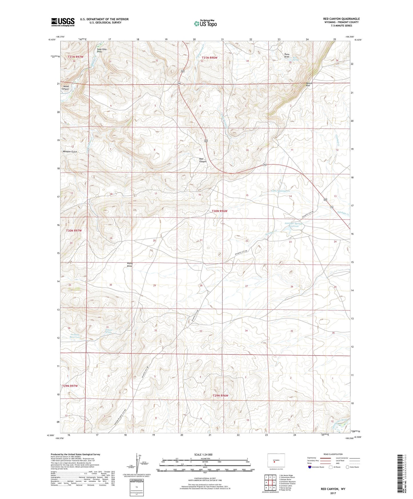
2021 topographic map quadrangle Red Canyon in the state of Wyoming. Scale: 1:24000. Based on the newly updated USGS 7.5' US Topo map series, this map is in the following counties: Fremont. The map contains contour data, water features, and other items you are used to seeing on USGS maps, but also has updated roads and other features. This is the next generation of topographic maps. Printed on high-quality waterproof paper with UV fade-resistant inks.
Quads adjacent to this one:
West: Schoettlin Mountain
Northwest: Del Monte Ridge
North: Yellowstone Ranch
Northeast: Dishpan Butte
East: Sweetwater Station
Southeast: Happy Spring
South: Barras Springs
Southwest: Lewiston Lakes
This map covers the same area as the classic USGS quad with code o42108e3.
Contains the following named places: Abernathy Deposit Number One Mine, Abernathy Deposit Number Two Mine, Antelope Springs Reservoir, Bain Spring, Beaver Creek Deposit, Beaver Divide Area Mine, Beaver Divide Mine, Cold Sulphur Creek, Jackson Reservoir, Jackson Spring, King Number Nine Mine, Little Antelope Creek, Miller Ditch, Popo Agie Number One Mine, Soap Hole Draw, Twin Creek Number Five Mine, Two C Number One Mine, Wood Canyon