MyTopo
Yellowstone Ranch Wyoming US Topo Map
Couldn't load pickup availability
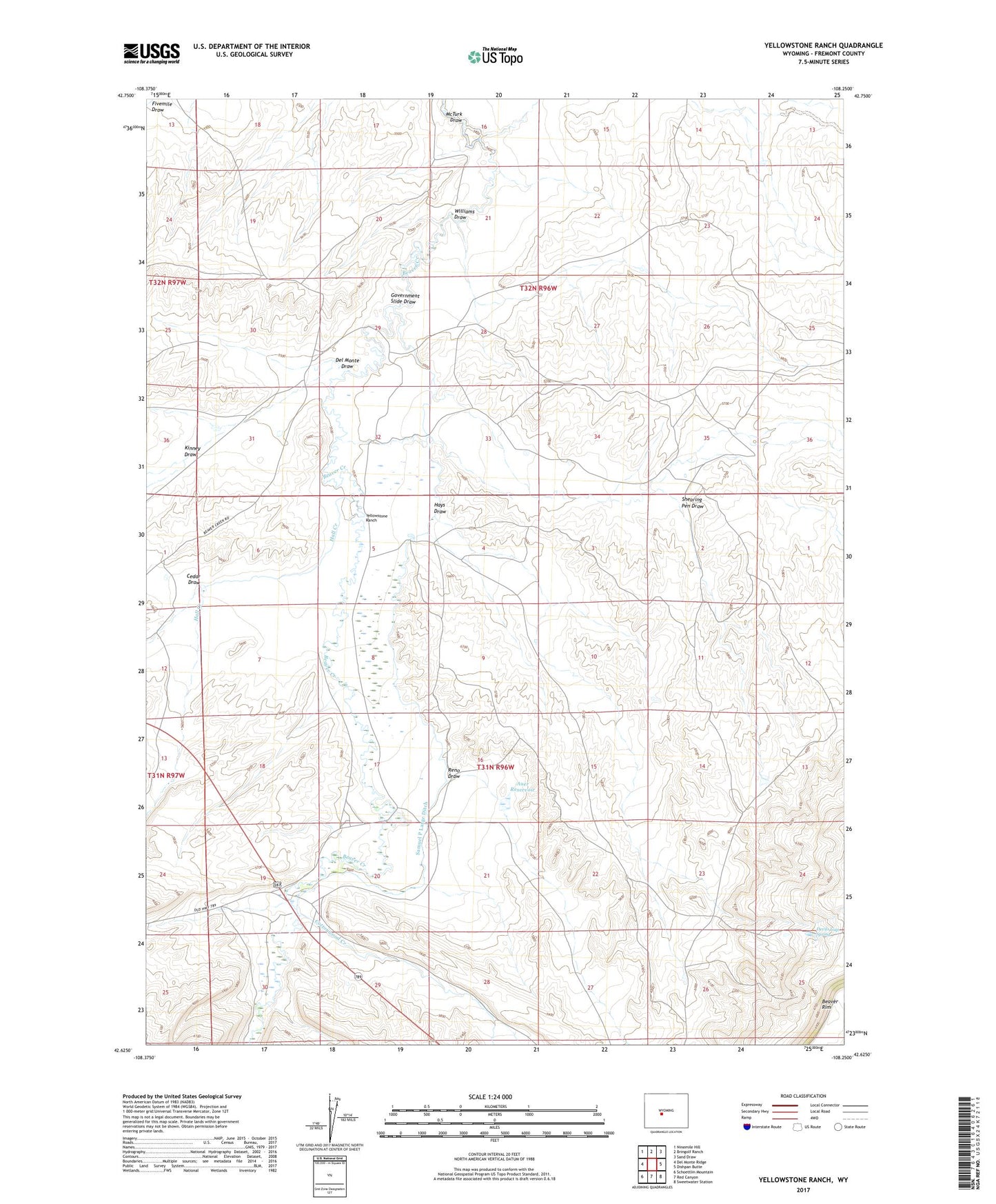
2021 topographic map quadrangle Yellowstone Ranch in the state of Wyoming. Scale: 1:24000. Based on the newly updated USGS 7.5' US Topo map series, this map is in the following counties: Fremont. The map contains contour data, water features, and other items you are used to seeing on USGS maps, but also has updated roads and other features. This is the next generation of topographic maps. Printed on high-quality waterproof paper with UV fade-resistant inks.
Quads adjacent to this one:
West: Del Monte Ridge
Northwest: Ninemile Hill
North: Bringolf Ranch
Northeast: Sand Draw
East: Dishpan Butte
Southeast: Sweetwater Station
South: Red Canyon
Southwest: Schoettlin Mountain
This map covers the same area as the classic USGS quad with code o42108f3.
Contains the following named places: Arthur Ranch, Auer Dam, Auer Reservoir, Cedar Draw, Cottonwood Creek, Del Monte Draw, Devils Gap Spring, Government Slide Draw, Hall Creek, Hays Draw, Henton Ranch, J Wade Claims, Kinney Draw, Marion Claim, McTurk Draw, Reno Draw, Samuel P Large Ditch, Shearing Pen Draw, Williams Draw, Yellowstone Ranch