MyTopo
Schoettlin Mountain Wyoming US Topo Map
Couldn't load pickup availability
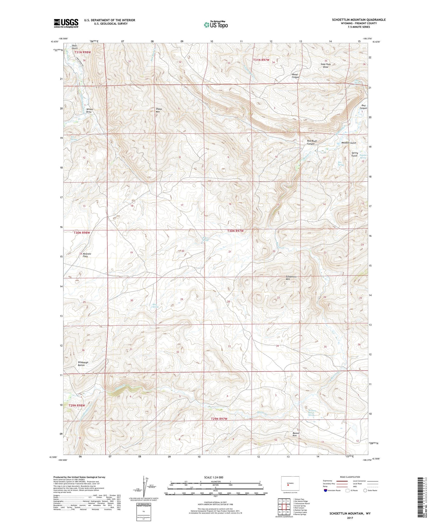
2021 topographic map quadrangle Schoettlin Mountain in the state of Wyoming. Scale: 1:24000. Based on the newly updated USGS 7.5' US Topo map series, this map is in the following counties: Fremont. The map contains contour data, water features, and other items you are used to seeing on USGS maps, but also has updated roads and other features. This is the next generation of topographic maps. Printed on high-quality waterproof paper with UV fade-resistant inks.
Quads adjacent to this one:
West: Gravel Spring
Northwest: Weiser Pass
North: Del Monte Ridge
Northeast: Yellowstone Ranch
East: Red Canyon
Southeast: Barras Springs
South: Lewiston Lakes
Southwest: Radium Springs
This map covers the same area as the classic USGS quad with code o42108e4.
Contains the following named places: Auer Ranch, Bergstedt Ranch, Box Spring, French George Crossing, Gyp Spring, Hot Spring, Level Meadows Creek, Little Beaver Creek, Mathisen Ranch, McGraw Flats, Meadow Gulch, Miller Ditch, Miller Spring, Mud Spring, Red Bluff Canyon, Red Canyon, Rock Ford, Schoettlin Mountain, Sheep Mountain, Skull Gulch, Spring Gulch, Sulphur Spring, Wilson Draw, Woolery Ranch Spring