
MyTopo
Evanston Wyoming US Topo Map
Couldn't load pickup availability
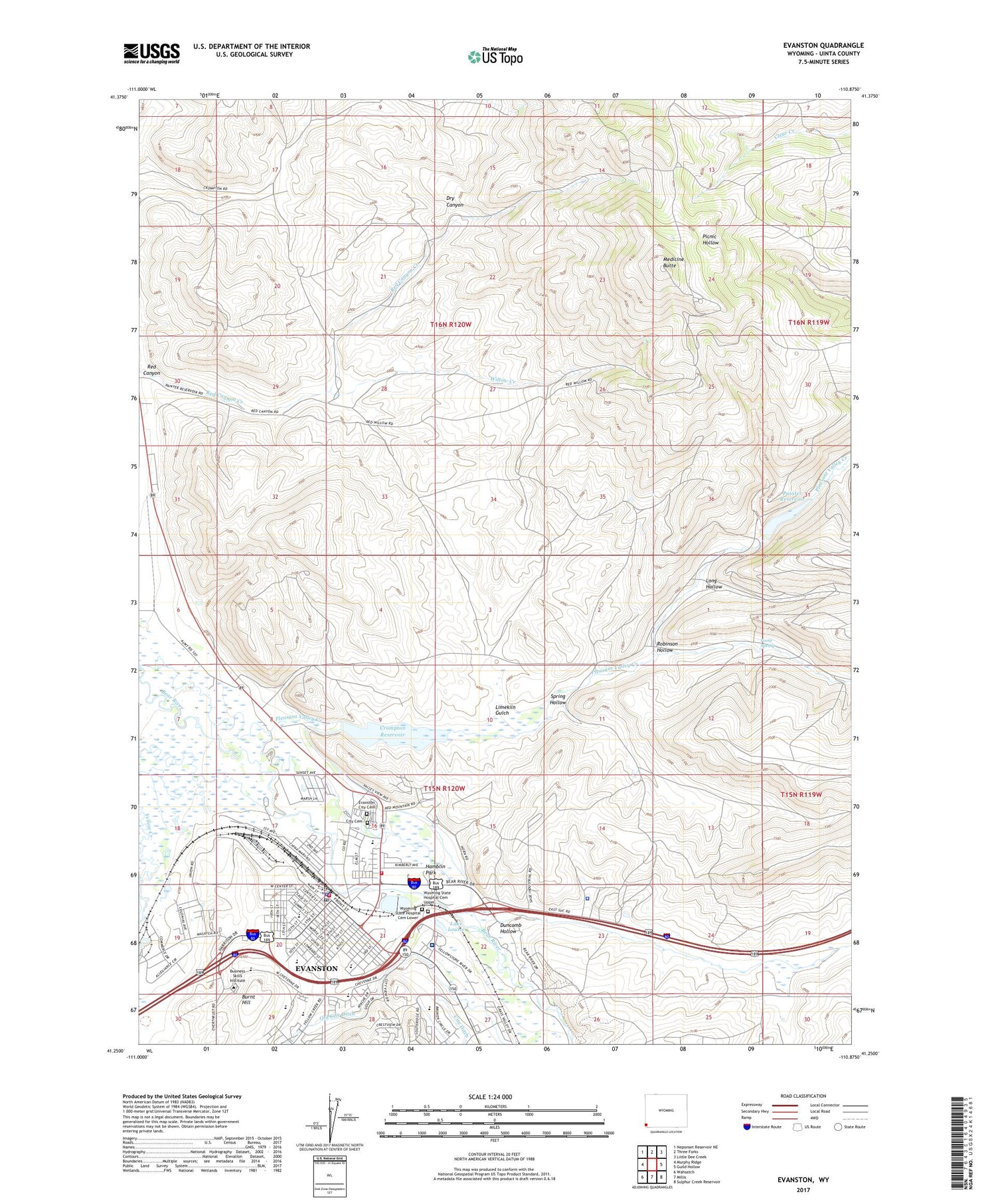
2021 topographic map quadrangle Evanston in the state of Wyoming. Scale: 1:24000. Based on the newly updated USGS 7.5' US Topo map series, this map is in the following counties: Uinta. The map contains contour data, water features, and other items you are used to seeing on USGS maps, but also has updated roads and other features. This is the next generation of topographic maps. Printed on high-quality waterproof paper with UV fade-resistant inks.
Quads adjacent to this one:
West: Murphy Ridge
Northwest: Neponset Reservoir NE
North: Three Forks
Northeast: Little Dee Creek
East: Guild Hollow
Southeast: Sulphur Creek Reservoir
South: Millis
Southwest: Wahsatch
Contains the following named places: Almy Number Five Mine, Almy Number Forty-one Mine, Almy Number Four Mine, Almy Number One Mine, Almy Number Thirty-one Mine, Almy Number Three Mine, Almy Number Two Mine, Aspen School, Bear River Mall, Burnt Hill, City Cemetery, City Ditch, City of Evanston, Clark School, Crompton Dam, Crompton Reservoir, Davis Middle School, Duncomb Hollow, Evanston, Evanston City Cemetery, Evanston High School, Evanston Middle School, Evanston Police Department, Evanston Post Office, Foote Spring, Front Street Mall, Hamblin Park, KOTB-FM (Evanston), Lake Louise, Limekiln Gulch, Long Hollow, Medicine Butte, North Evanston School, Old City Ditch, Painter Dam, Painter Reservoir, Pioneer Counseling Resource Services Hospital, Pleasant Valley Creek, Red Canyon, Robinson Hollow, Rocky Mountain Care Hospital of Evanston, Spring Hollow, Uinta County Fire Protection Evanston Station 1, Uinta County Fire Protection Evanston Station 2, Uinta County Sheriff's Office, Uinta Meadows School, Willow Creek, Wyoming State Hospital, Wyoming State Hospital Cemetery Lower, Wyoming State Hospital Cemetery Upper, Yellow Creek Shopping Mall


