MyTopo
Sulphur Creek Reservoir Wyoming US Topo Map
Couldn't load pickup availability
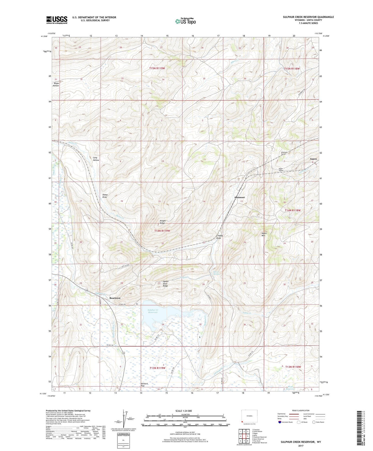
2021 topographic map quadrangle Sulphur Creek Reservoir in the state of Wyoming. Scale: 1:24000. Based on the newly updated USGS 7.5' US Topo map series, this map is in the following counties: Uinta. The map contains contour data, water features, and other items you are used to seeing on USGS maps, but also has updated roads and other features. This is the next generation of topographic maps. Printed on high-quality waterproof paper with UV fade-resistant inks.
Quads adjacent to this one:
West: Millis
Northwest: Evanston
North: Guild Hollow
Northeast: Ragan
East: Piedmont Reservoir
Southeast: Moslander Reservoir
South: Pine Knoll
Southwest: Myers Reservoir
This map covers the same area as the classic USGS quad with code o41110b7.
Contains the following named places: Altamont, Altamont Tunnel, Aspen, Aspen Creek, Aspen Mountain, Aspen Tunnel, Barrel Springs, Bazoo Hollow Creek, Beartown, Choppy Draw, Emigrant Trail, Hilliard, Knight Ridge, LaChapelle Creek, Long Hollow, Oyster Shell Ridge, Rock Cut, Sheep Draw, Sulphur Creek, Sulphur Creek Dam, Sulphur Creek Reservoir