MyTopo
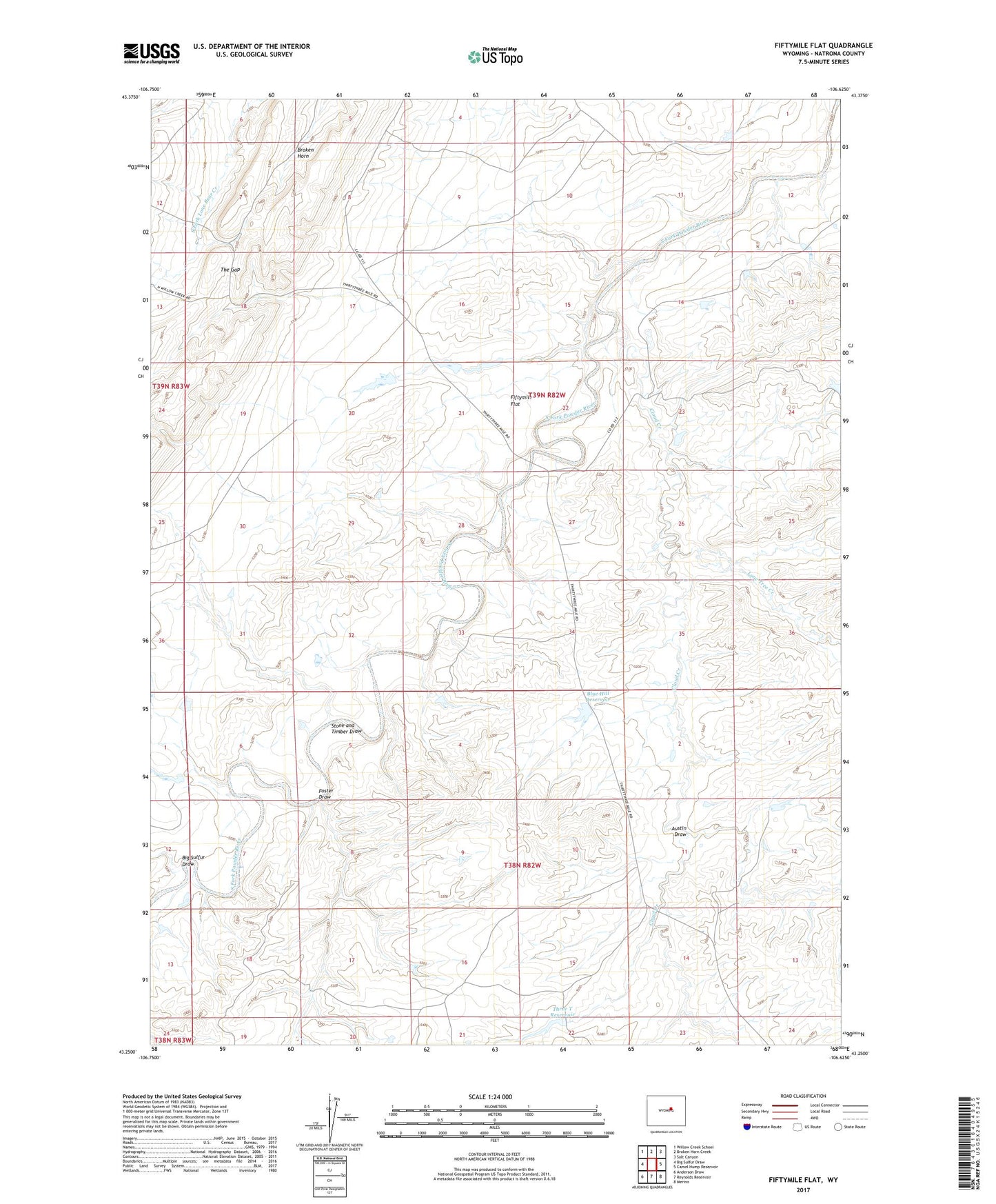
Fiftymile Flat Wyoming US Topo Map
Couldn't load pickup availability
2021 topographic map quadrangle Fiftymile Flat in the state of Wyoming. Scale: 1:24000. Based on the newly updated USGS 7.5' US Topo map series, this map is in the following counties: Natrona. The map contains contour data, water features, and other items you are used to seeing on USGS maps, but also has updated roads and other features. This is the next generation of topographic maps. Printed on high-quality waterproof paper with UV fade-resistant inks.
Quads adjacent to this one:
West: Big Sulfur Draw
Northwest: Willow Creek School
North: Broken Horn Creek
Northeast: Salt Canyon
East: Camel Hump Reservoir
Southeast: Merino
South: Reynolds Reservoir
Southwest: Anderson Draw
This map covers the same area as the classic USGS quad with code o43106c6.
Contains the following named places: Austin Draw, Big Sulfur Draw, Blue Hill, Blue Hill Reservoir, Broken Horn, Cloud Creek, Fiftymile Flat, Foster Draw, Jack Dam, Jack Ellis Camp, Jack Reservoir, Kidd Ranch Number Twenty-five Mine, Lone Tree Creek, Powder River Corral, Stone and Timber Draw, The Gap, Three T Reservoir