
MyTopo
Fish Lake Wyoming US Topo Map
Couldn't load pickup availability
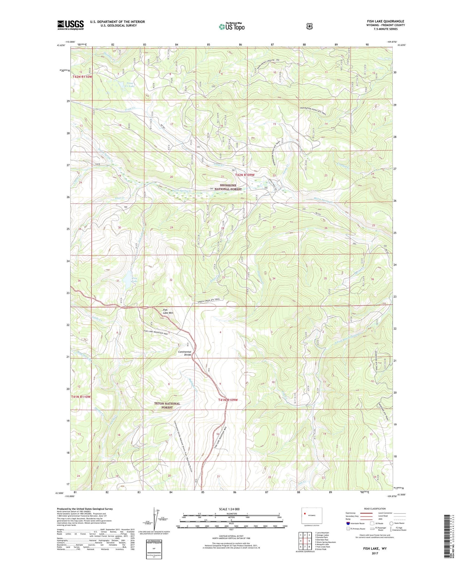
2021 topographic map quadrangle Fish Lake in the state of Wyoming. Scale: 1:24000. Based on the newly updated USGS 7.5' US Topo map series, this map is in the following counties: Fremont. The map contains contour data, water features, and other items you are used to seeing on USGS maps, but also has updated roads and other features. This is the next generation of topographic maps. Printed on high-quality waterproof paper with UV fade-resistant inks.
Quads adjacent to this one:
West: Sheridan Pass
Northwest: Lava Mountain
North: Kisinger Lakes
Northeast: Esmond Park
East: Warm Spring Mountain
Southeast: Union Peak
South: Fish Creek Park
Southwest: Mosquito Lake
Contains the following named places: Bullmoose Creek, Camp Creek, Cow Creek, Coyote Creek, Dead Horse Creek, Devils Hole Trail, Enos Creek, Fish Lake, Fish Lake Creek, Fish Lake Mountain, Fish Lake Trail, Green Creek, Indian Creek, Leeds Creek Trail, Quaker Creek, Red Flat Cow Camp, Salt Creek, Spring Creek, Trappers Creek, Trout Creek, Trout Creek Lake


