MyTopo
Twin Peaks Wyoming US Topo Map
Couldn't load pickup availability
Also explore the Twin Peaks Forest Service Topo of this same quad for updated USFS data
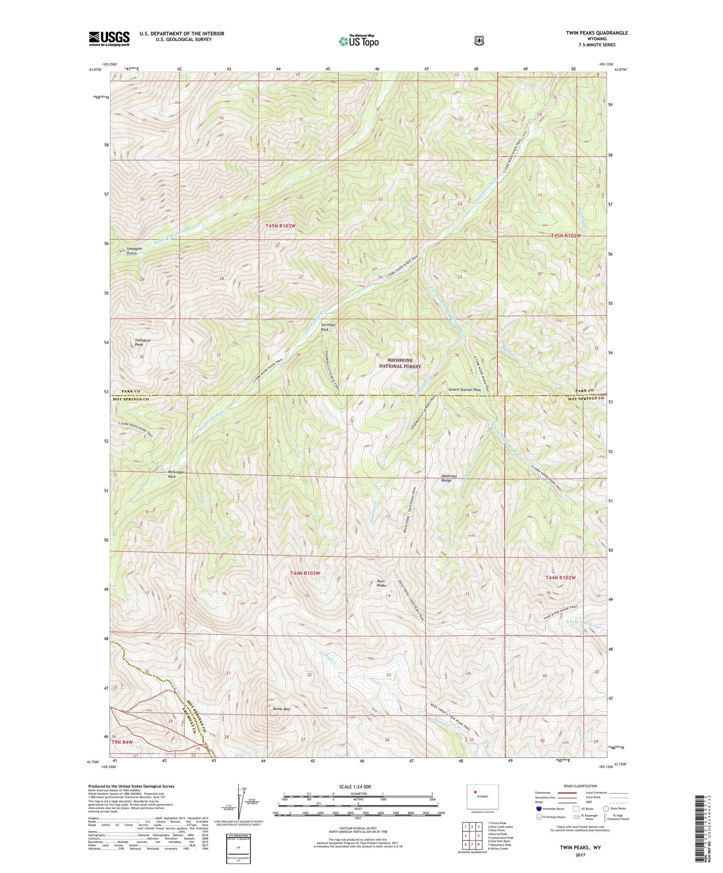
2021 topographic map quadrangle Twin Peaks in the state of Wyoming. Scale: 1:24000. Based on the newly updated USGS 7.5' US Topo map series, this map is in the following counties: Hot Springs, Park, Fremont. The map contains contour data, water features, and other items you are used to seeing on USGS maps, but also has updated roads and other features. This is the next generation of topographic maps. Printed on high-quality waterproof paper with UV fade-resistant inks.
Quads adjacent to this one:
West: Dunrud Peak
Northwest: Francs Peak
North: Dick Creek Lakes
Northeast: Noon Point
East: Cottonwood Peak
Southeast: Willow Creek
South: Monument Peak
Southwest: East Fork Basin
This map covers the same area as the classic USGS quad with code o43109g2.
Contains the following named places: Blanchette Creek, Buckle Creek, Deadman Creek, Dome Mountain, East Fork South Fork Wood River, Guard Station Park, McGregor Park, Rock Creek Trail, Slaughter Creek, Smuggler Gulch, Standard Peak, Surveyor Park, Twin Peaks, Wind River Trail