MyTopo
Gobblers Knob Wyoming US Topo Map
Couldn't load pickup availability
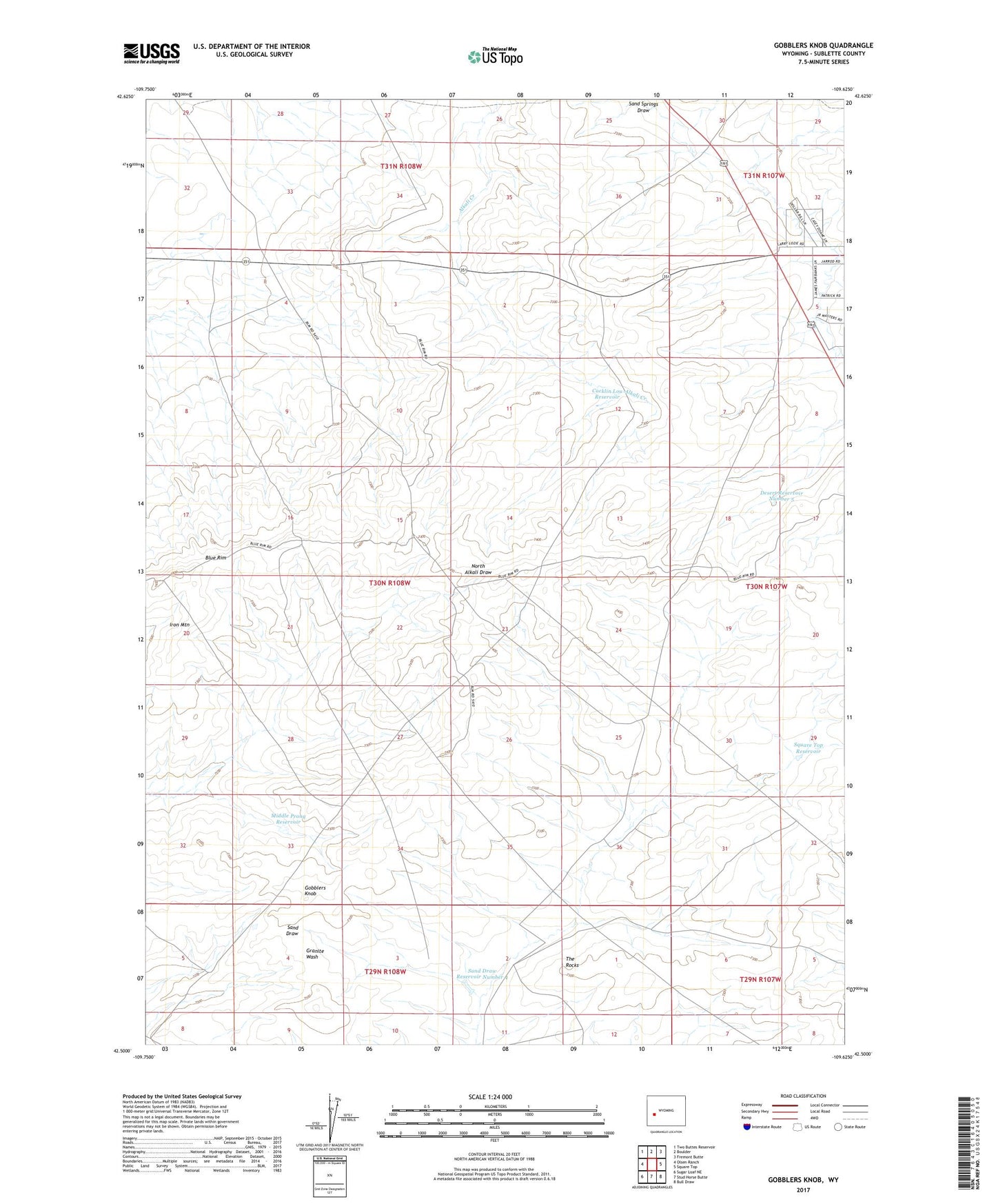
2021 topographic map quadrangle Gobblers Knob in the state of Wyoming. Scale: 1:24000. Based on the newly updated USGS 7.5' US Topo map series, this map is in the following counties: Sublette. The map contains contour data, water features, and other items you are used to seeing on USGS maps, but also has updated roads and other features. This is the next generation of topographic maps. Printed on high-quality waterproof paper with UV fade-resistant inks.
Quads adjacent to this one:
West: Olsen Ranch
Northwest: Two Buttes Reservoir
North: Boulder
Northeast: Fremont Butte
East: Square Top
Southeast: Bull Draw
South: Stud Horse Butte
Southwest: Sugar Loaf NE
This map covers the same area as the classic USGS quad with code o42109e6.
Contains the following named places: Badger Draw Reservoir, Blue Rim, Buckhorn Well Number 1, Buckhorn Well Number 5, Cacklin Lou Reservoir, Desert Reservoir Number 5, Gobblers Knob, Granite Road Reservoir, Iron Mountain, Middle Prong Reservoir, Sand Draw Reservoir Number 4, Sand Springs Well Number 1, Shelter Cabin Reservoir, Square Top Drift Fence, Square Top Reservoir, Surveyors Draw Reservoir, The Rocks