MyTopo
Boulder Wyoming US Topo Map
Couldn't load pickup availability
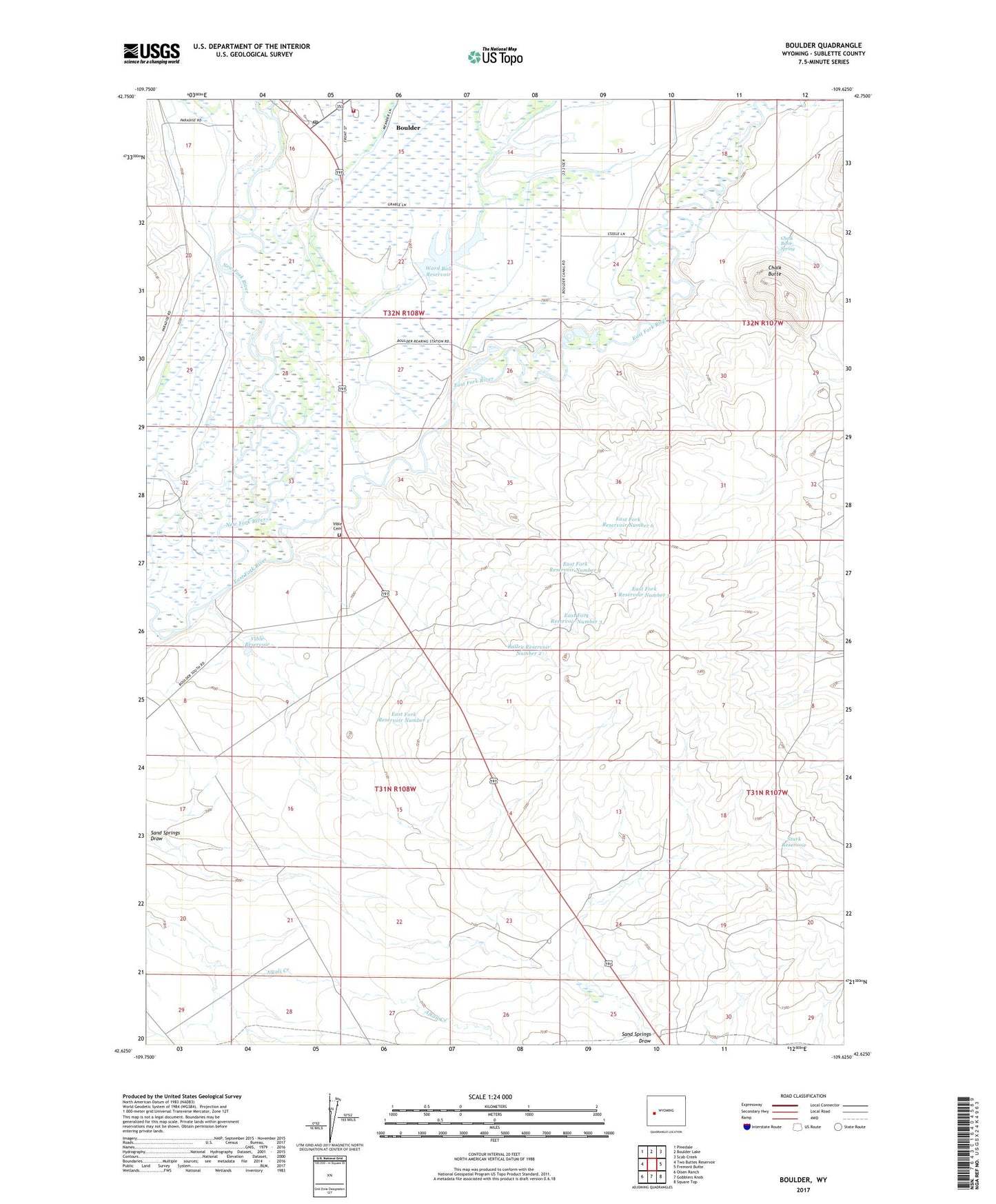
2021 topographic map quadrangle Boulder in the state of Wyoming. Scale: 1:24000. Based on the newly updated USGS 7.5' US Topo map series, this map is in the following counties: Sublette. The map contains contour data, water features, and other items you are used to seeing on USGS maps, but also has updated roads and other features. This is the next generation of topographic maps. Printed on high-quality waterproof paper with UV fade-resistant inks.
Quads adjacent to this one:
West: Two Buttes Reservoir
Northwest: Pinedale
North: Boulder Lake
Northeast: Scab Creek
East: Fremont Butte
Southeast: Square Top
South: Gobblers Knob
Southwest: Olsen Ranch
This map covers the same area as the classic USGS quad with code o42109f6.
Contains the following named places: Bailey Reservoir Number 2, Ball Ditch, Boulder, Boulder Census Designated Place, Boulder Creek, Boulder Fire Battalion, Boulder Fish Hatchery, Boulder Post Office, Chalk Butte, Chalk Butte Spring, East Fork Reservoir Number 1, East Fork Reservoir Number 3, East Fork Reservoir Number 4, East Fork Reservoir Number 5, East Fork Reservoir Number 6, East Fork River, Green River Retention Dam Number 5, Green River Retention Dam Number 6, Last Chance Ditch, Naylor Ditch, New Fork, Stark Reservoir, Vible Cemetery, Vible Reservoir, Ward Ball Dam, Ward Ball Reservoir