MyTopo
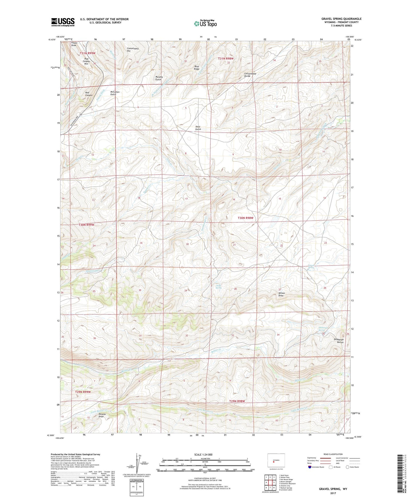
Gravel Spring Wyoming US Topo Map
Couldn't load pickup availability
2021 topographic map quadrangle Gravel Spring in the state of Wyoming. Scale: 1:24000. Based on the newly updated USGS 7.5' US Topo map series, this map is in the following counties: Fremont. The map contains contour data, water features, and other items you are used to seeing on USGS maps, but also has updated roads and other features. This is the next generation of topographic maps. Printed on high-quality waterproof paper with UV fade-resistant inks.
Quads adjacent to this one:
West: Miners Delight
Northwest: Wolf Point
North: Weiser Pass
Northeast: Del Monte Ridge
East: Schoettlin Mountain
Southeast: Lewiston Lakes
South: Radium Springs
Southwest: Atlantic City
Contains the following named places: Blue Ridge, Chalk Spring, Chapman Homestead, Commissary Hill, Dilabaugh Buttes, Dilabaugh Spring, Duncan Draw, Gravel Spring, Gustin Homestead, Schlichting Ditch, Southeast Wind River District Mine, Stambaugh Creek, Tweed Creek, Tweed Ditch, Usher Creek Mine