MyTopo
Lewiston Lakes Wyoming US Topo Map
Couldn't load pickup availability
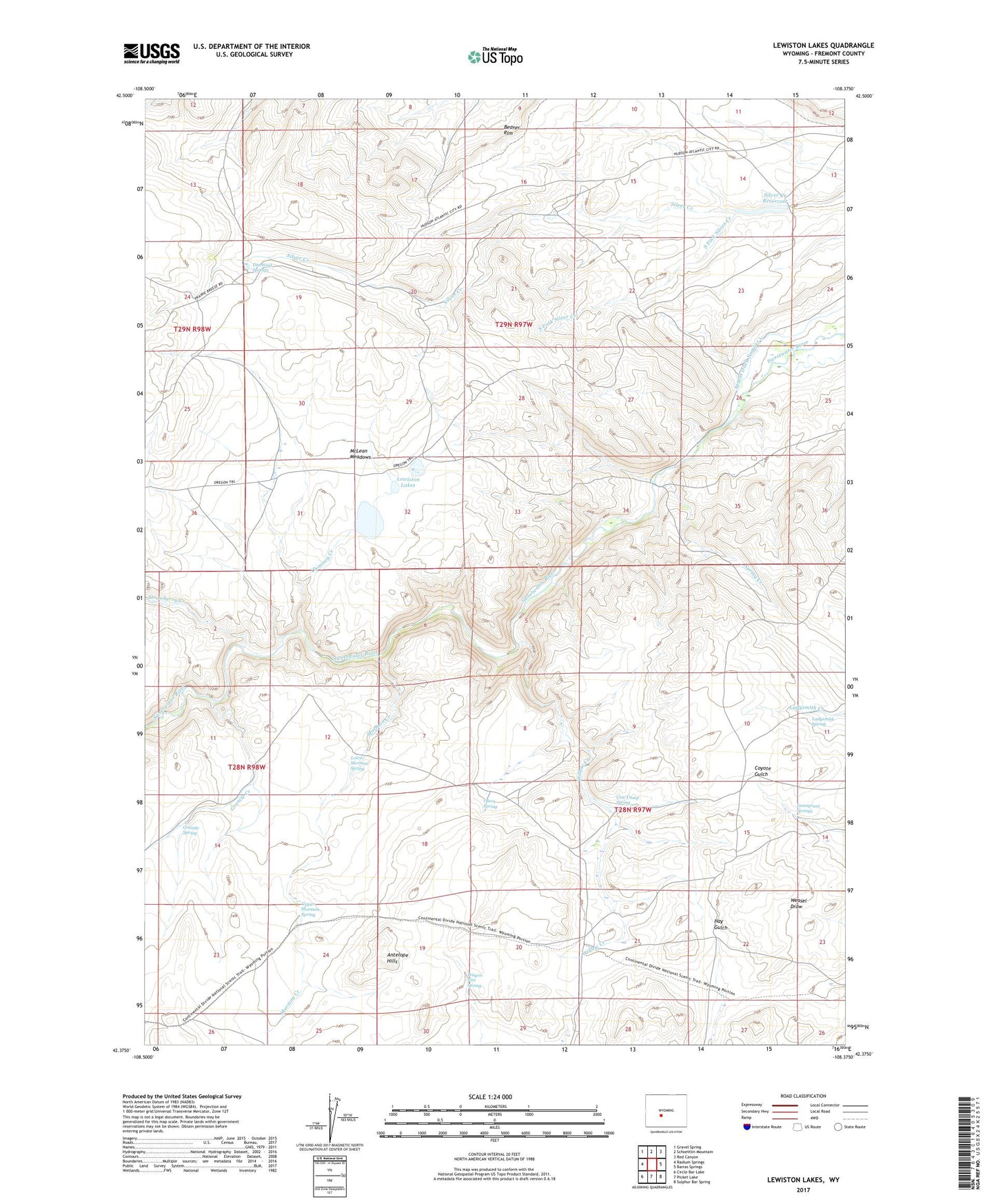
2021 topographic map quadrangle Lewiston Lakes in the state of Wyoming. Scale: 1:24000. Based on the newly updated USGS 7.5' US Topo map series, this map is in the following counties: Fremont. The map contains contour data, water features, and other items you are used to seeing on USGS maps, but also has updated roads and other features. This is the next generation of topographic maps. Printed on high-quality waterproof paper with UV fade-resistant inks.
Quads adjacent to this one:
West: Radium Springs
Northwest: Gravel Spring
North: Schoettlin Mountain
Northeast: Red Canyon
East: Barras Springs
Southeast: Sulphur Bar Spring
South: Picket Lake
Southwest: Circle Bar Lake
This map covers the same area as the classic USGS quad with code o42108d4.
Contains the following named places: Arnold Ditch Number 1, Canoys Cabin, Chimney Creek, Cow Camp Spring, Diamond Springs, Granite Creek, Granite Spring, Immigrant Springs, Ladysmith Spring, Lewiston Lakes, Lower Mormon Spring, McLean Meadows, Mormon Creek, Olson Spring, Silver Creek Dam, Silver Creek Reservoir, South Fork Silver Creek, Spring Creek, Strawberry Creek, Upper Mormon Spring, Wagon Tire Spring, Willow Creek, Yellowstone Cow Camp