MyTopo
Green Top Mountain Wyoming US Topo Map
Couldn't load pickup availability
Also explore the Green Top Mountain Forest Service Topo of this same quad for updated USFS data
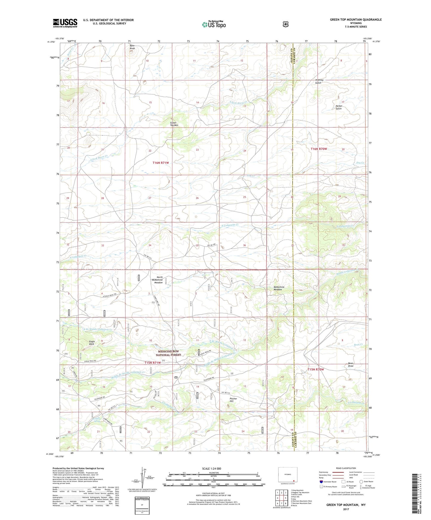
2021 topographic map quadrangle Green Top Mountain in the state of Wyoming. Scale: 1:24000. Based on the newly updated USGS 7.5' US Topo map series, this map is in the following counties: Albany, Laramie. The map contains contour data, water features, and other items you are used to seeing on USGS maps, but also has updated roads and other features. This is the next generation of topographic maps. Printed on high-quality waterproof paper with UV fade-resistant inks.
Quads adjacent to this one:
West: Pilot Hill
Northwest: King Mountain
North: Ragged Top Mountain
Northeast: Horse Creek
East: Islay
Southeast: Hecla
South: Sherman Mountains East
Southwest: Sherman Mountains West
This map covers the same area as the classic USGS quad with code o41105c3.
Contains the following named places: Artillery Spring, Bare Knob, Cameron Ranch, Davis Ranch, Davis Range Camp, Eagle Rock, Green Top Mountain, Horse Creek Trail, McKechnie Meadow, Meadow Fork Branch, Middle Branch Middle Lodgepole Creek, Mine Camp, North Branch Middle Lodgepole Creek, North McKechnie Meadow, Pitcher Hill, Tetsc Ranch, Weddle Claims Mine