MyTopo
Sherman Mountains East Wyoming US Topo Map
Couldn't load pickup availability
Also explore the Sherman Mountains East Forest Service Topo of this same quad for updated USFS data
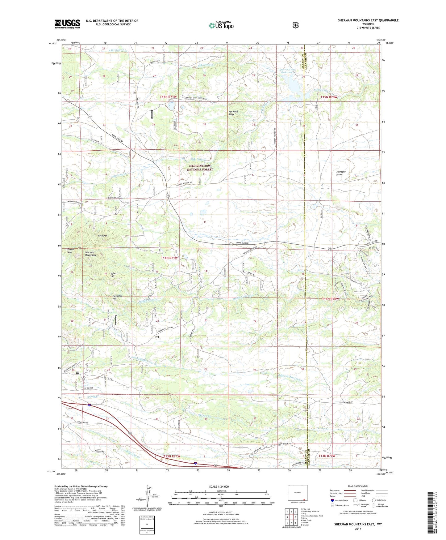
2021 topographic map quadrangle Sherman Mountains East in the state of Wyoming. Scale: 1:24000. Based on the newly updated USGS 7.5' US Topo map series, this map is in the following counties: Albany, Laramie. The map contains contour data, water features, and other items you are used to seeing on USGS maps, but also has updated roads and other features. This is the next generation of topographic maps. Printed on high-quality waterproof paper with UV fade-resistant inks.
Quads adjacent to this one:
West: Sherman Mountains West
Northwest: Pilot Hill
North: Green Top Mountain
Northeast: Islay
East: Hecla
Southeast: Granite
South: Buford
Southwest: Dale Creek
This map covers the same area as the classic USGS quad with code o41105b3.
Contains the following named places: Bar Ed Ranch, Brady Rock Trail, Buford Trail, Camp Holiday, Devils Playground, Egbert Hill, Green Mountain, Hirsig, Kinnaman Ranch, Lattas Ranch Trail, Lazy Heart 9 Ranch, Middle Crow Camp, Monte Cristo Mine, North Branch Crow Creek, Reynolds Hill, South Branch Crow Creek, Turtle Rock, Twin Mountain, Upper North Crow Reservoir, Upper Van Tassell Dam, Upper Van Tassell Reservoir, Van Horn Ridge, Vedauwoo Campground, Vedauwoo Glen