MyTopo
Hawk Springs Wyoming US Topo Map
Couldn't load pickup availability
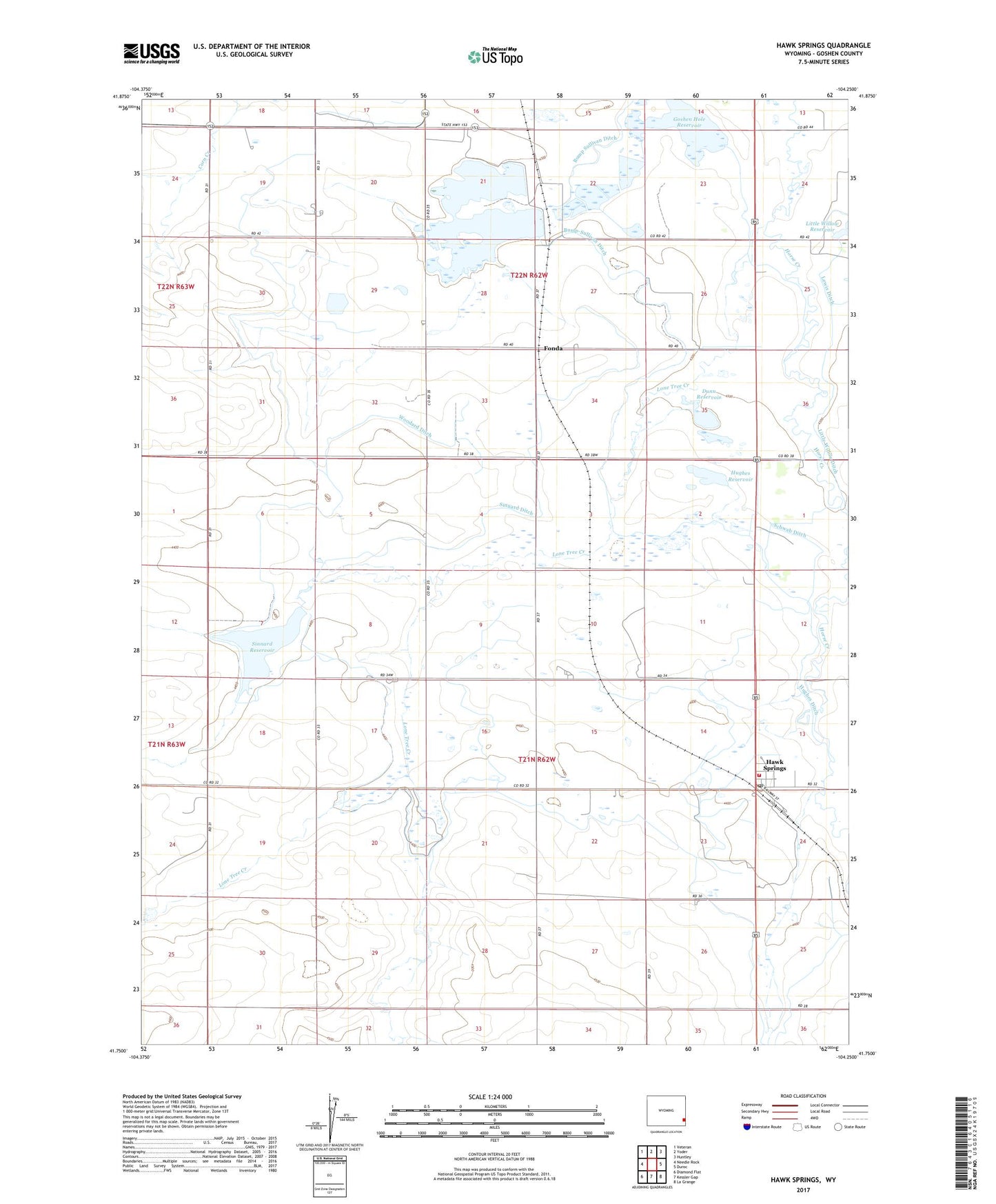
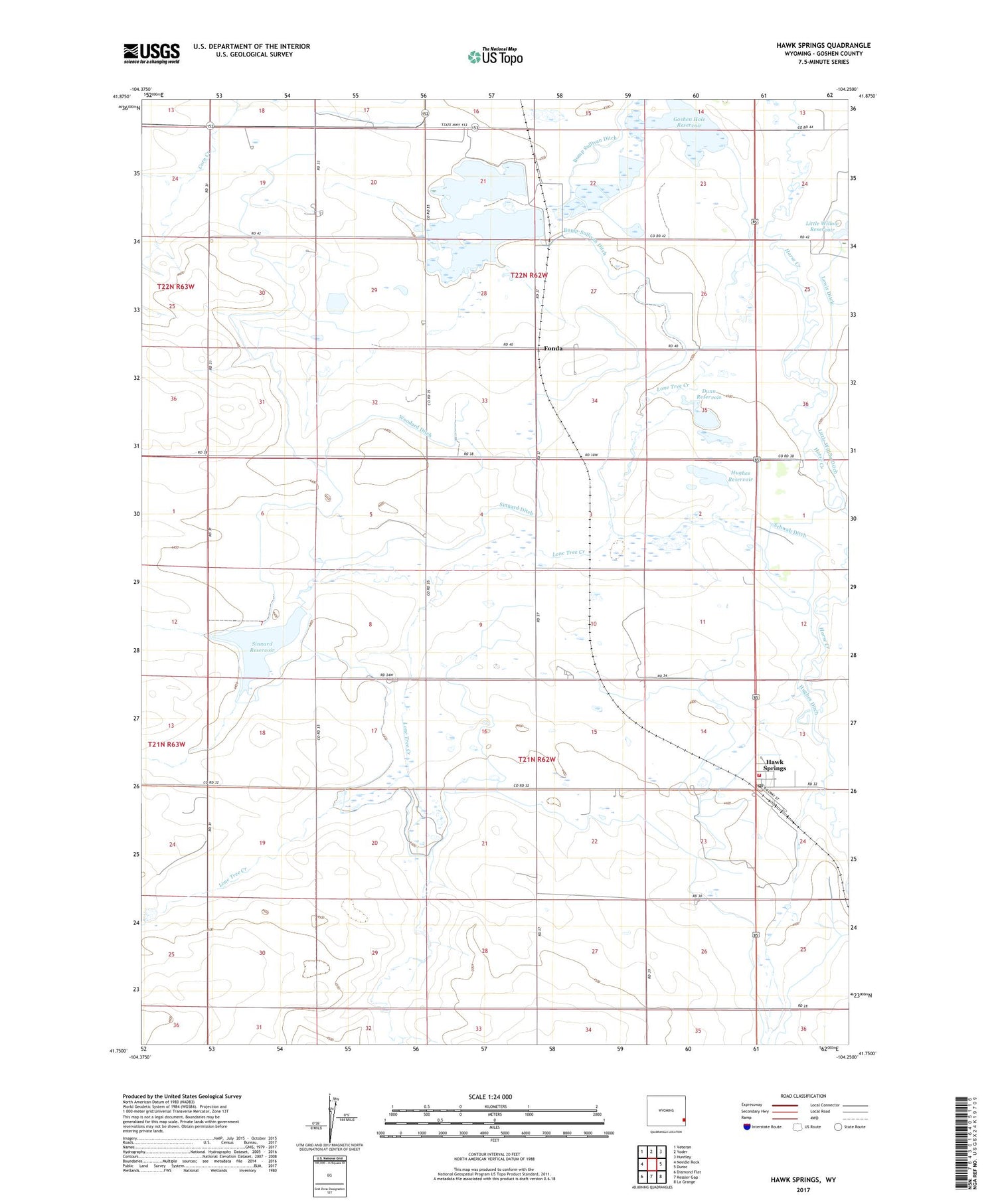
2021 topographic map quadrangle Hawk Springs in the state of Wyoming. Scale: 1:24000. Based on the newly updated USGS 7.5' US Topo map series, this map is in the following counties: Goshen. The map contains contour data, water features, and other items you are used to seeing on USGS maps, but also has updated roads and other features. This is the next generation of topographic maps. Printed on high-quality waterproof paper with UV fade-resistant inks.
Quads adjacent to this one:
West: Needle Rock
Northwest: Veteran
North: Yoder
Northeast: Huntley
East: Duroc
Southeast: La Grange
South: Kessler Gap
Southwest: Diamond Flat
Contains the following named places: Bump-Sullivan Ditch, Dunn Reservoir, Fonda, Goodland, Goshen County Fire District 5C - Hawk Springs Fire Department, Goshen Numbers 1 and 2 Dam, Goshen Reservoirs Numbers 1 and 2, Hawk Springs, Hawk Springs Census Designated Place, Hawk Springs Post Office, Howery Dam, Howery Reservoir, Hughes Ditch, Hughes Reservoir, Little Willow Ditch, Little Willow Reservoir, Little Willow Reservoir Dam, Lone Tree Creek, Schwab Ditch, Sinnard Dam, Sinnard Ditch, Sinnard Reservoir, Springer Ditch, Springer Wildlife Mangement Unit, Woodard Ditch