MyTopo
Huntley Wyoming US Topo Map
Couldn't load pickup availability
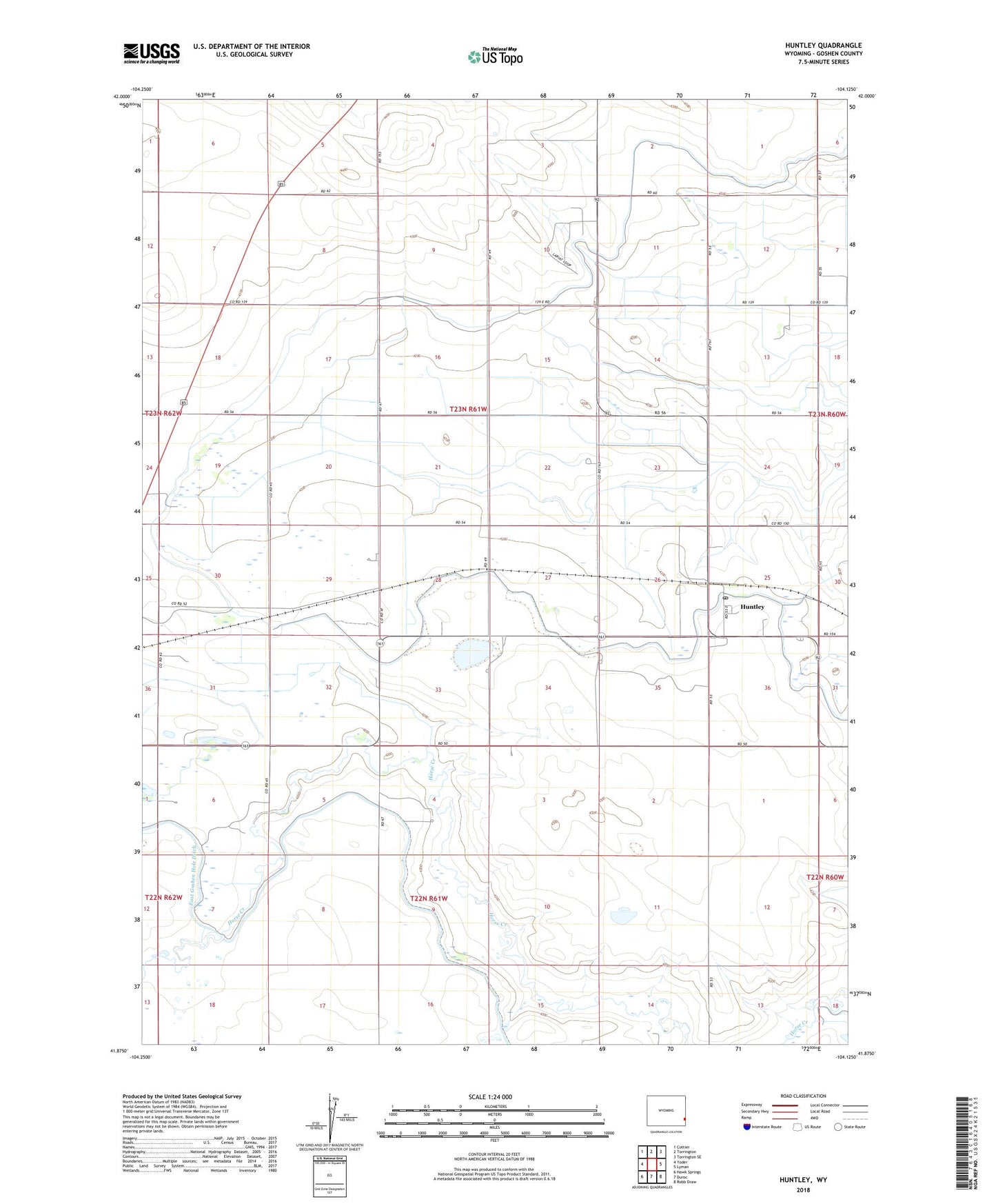
2021 topographic map quadrangle Huntley in the state of Wyoming. Scale: 1:24000. Based on the newly updated USGS 7.5' US Topo map series, this map is in the following counties: Goshen. The map contains contour data, water features, and other items you are used to seeing on USGS maps, but also has updated roads and other features. This is the next generation of topographic maps. Printed on high-quality waterproof paper with UV fade-resistant inks.
Quads adjacent to this one:
West: Yoder
Northwest: Cottier
North: Torrington
Northeast: Torrington SE
East: Lyman
Southeast: Robb Draw
South: Duroc
Southwest: Hawk Springs
This map covers the same area as the classic USGS quad with code o41104h2.
Contains the following named places: East Goshen Hole Ditch, East Springer Main Lateral, Frazier Drain, Hillview Home, Holly, Huntley, Huntley Census Designated Place, Huntley Post Office, Jones Drain, J-Pen Drain, Katzer Dam Number 3, Katzer Drain Branch A, Katzer Drain Branch B, Katzer Drain Branch C, Katzer Drain Branch D, Katzer Main Drain, Katzer Reservoir Number 3, KERM-FM (Torrington), Kumelos Drain, Lamma Drain, Layton Drain, Layton Drain Branch A, Springer Lateral, Springer Main Lateral