MyTopo
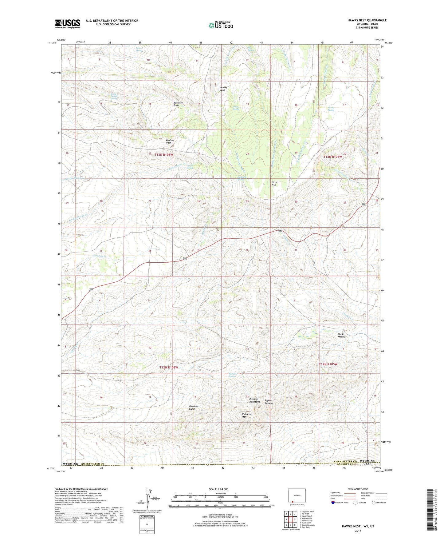
Hawks Nest Wyoming US Topo Map
Couldn't load pickup availability
2021 topographic map quadrangle Hawks Nest in the state of Wyoming. Scale: 1:24000. Based on the newly updated USGS 7.5' US Topo map series, this map is in the following counties: Sweetwater, Daggett. The map contains contour data, water features, and other items you are used to seeing on USGS maps, but also has updated roads and other features. This is the next generation of topographic maps. Printed on high-quality waterproof paper with UV fade-resistant inks.
Quads adjacent to this one:
West: Minnies Gap
Northwest: Sugarloaf Basin
North: Big Ridge
Northeast: Maxon Ranch
East: Richards Gap
Southeast: Clay Basin
South: Goslin Mountain
Southwest: Dutch John
Contains the following named places: Angelovie Spring, Bates Spring, Big Spring, Buckskin Basin, Davis Spring, Hanks Meadow, Harris Spring, Hawks Nest, Little Mountain, Lousy George Spring, Parea Spring, Red Jeep Number One Mine, Richards Mountain, Richards Spring