MyTopo
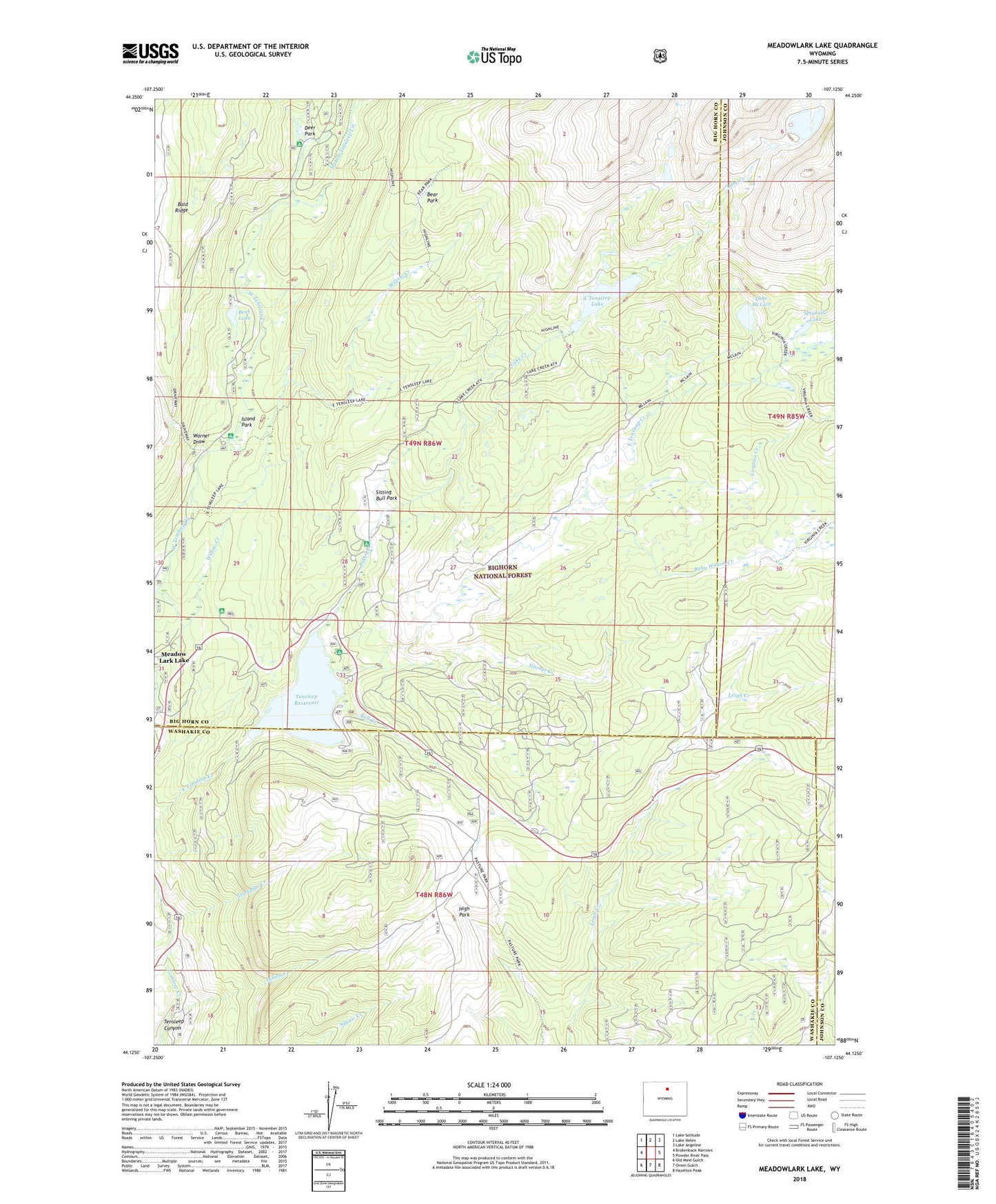
Meadowlark Lake Wyoming US Topo Map
Couldn't load pickup availability
Also explore the Meadowlark Lake Forest Service Topo of this same quad for updated USFS data
2023 topographic map quadrangle Meadowlark Lake in the state of Wyoming. Scale: 1:24000. Based on the newly updated USGS 7.5' US Topo map series, this map is in the following counties: Big Horn, Washakie, Johnson. The map contains contour data, water features, and other items you are used to seeing on USGS maps, but also has updated roads and other features. This is the next generation of topographic maps. Printed on high-quality waterproof paper with UV fade-resistant inks.
Quads adjacent to this one:
West: Brokenback Narrows
Northwest: Lake Solitude
North: Lake Helen
Northeast: Lake Angeline
East: Powder River Pass
Southeast: Hazelton Peak
South: Onion Gulch
Southwest: Old Maid Gulch
This map covers the same area as the classic USGS quad with code o44107b2.
Contains the following named places: Baby Wagon Creek, Bear Lake, Bear Park, Bull Creek, Bull Creek Campground, Deer Haven Lodge, Deer Park, Deer Park Campground, East Tensleep Lake, Garnet Creek, High Park, High Park Lookout, Indian Creek, Island Park, Island Park Campground, Lake Creek, Lake Creek Campground, Lake McLain, Lake Point Campground, Lake View Campground, Maybelle Lake, Meadow Lark Lake Census Designated Place, Meadowlark Lake, Meadowlark Lodge, Meadowlark Ski Area, Middle Tensleep Creek, Saint Christopher in the Bighorn, Sitting Bull Campground, Sitting Bull Park, Stovepipe Creek, Tensleep Reservoir, Tensleep Reservoir Dam, Varneys Memorial Camp, Virginia Creek, Warner Draw, Willow Creek, Willow Park Picnic Area