MyTopo
Hyatt Ranch Wyoming US Topo Map
Couldn't load pickup availability
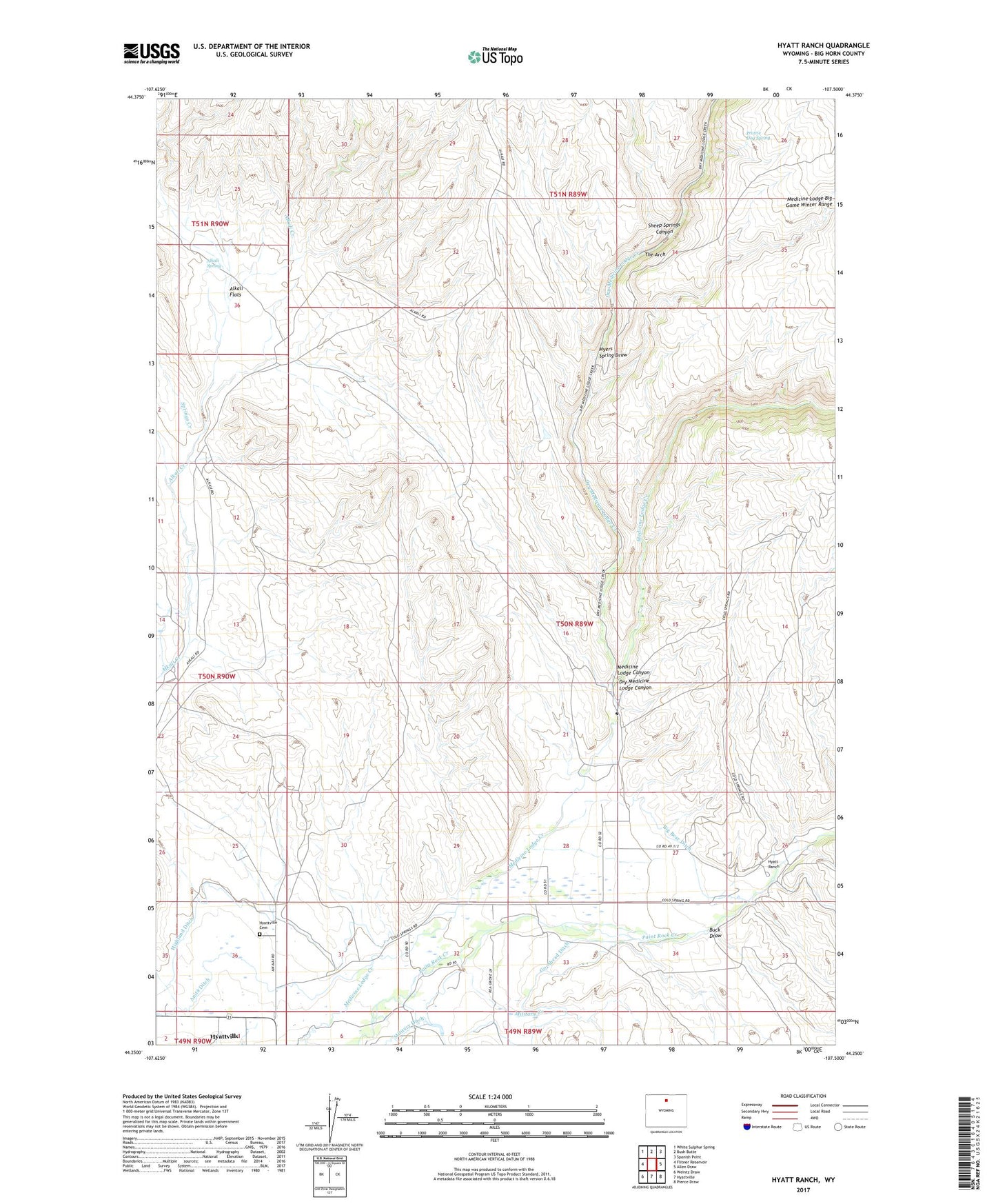
2021 topographic map quadrangle Hyatt Ranch in the state of Wyoming. Scale: 1:24000. Based on the newly updated USGS 7.5' US Topo map series, this map is in the following counties: Big Horn. The map contains contour data, water features, and other items you are used to seeing on USGS maps, but also has updated roads and other features. This is the next generation of topographic maps. Printed on high-quality waterproof paper with UV fade-resistant inks.
Quads adjacent to this one:
West: Flitner Reservoir
Northwest: White Sulphur Spring
North: Bush Butte
Northeast: Spanish Point
East: Allen Draw
Southeast: Pierce Draw
South: Hyattville
Southwest: Weintz Draw
This map covers the same area as the classic USGS quad with code o44107c5.
Contains the following named places: Alkali Flats, Alkali Spring, Big Bear Ditch, Buck Draw, Dry Medicine Lodge Canyon, Dry Medicine Lodge Creek, Enlargement of the Walters Dam, Go-Ahead Ditch, Greer Ranch, Highland Ditch, Hyatt Ranch, Hyattville Cemetery, Luman Creek, Medicine Lodge Canyon, Military Creek, Military Ditch, Myers Spring Draw, Paintrock Area Mine, Prairie Dog Spring, Pritchards Grove Picnic Area, Sheep Springs Canyon, Shirran Pit, Springs Creek, Taylor Ranch, The Arch, Walters Supply Ditch, ZIP Code: 82428