MyTopo
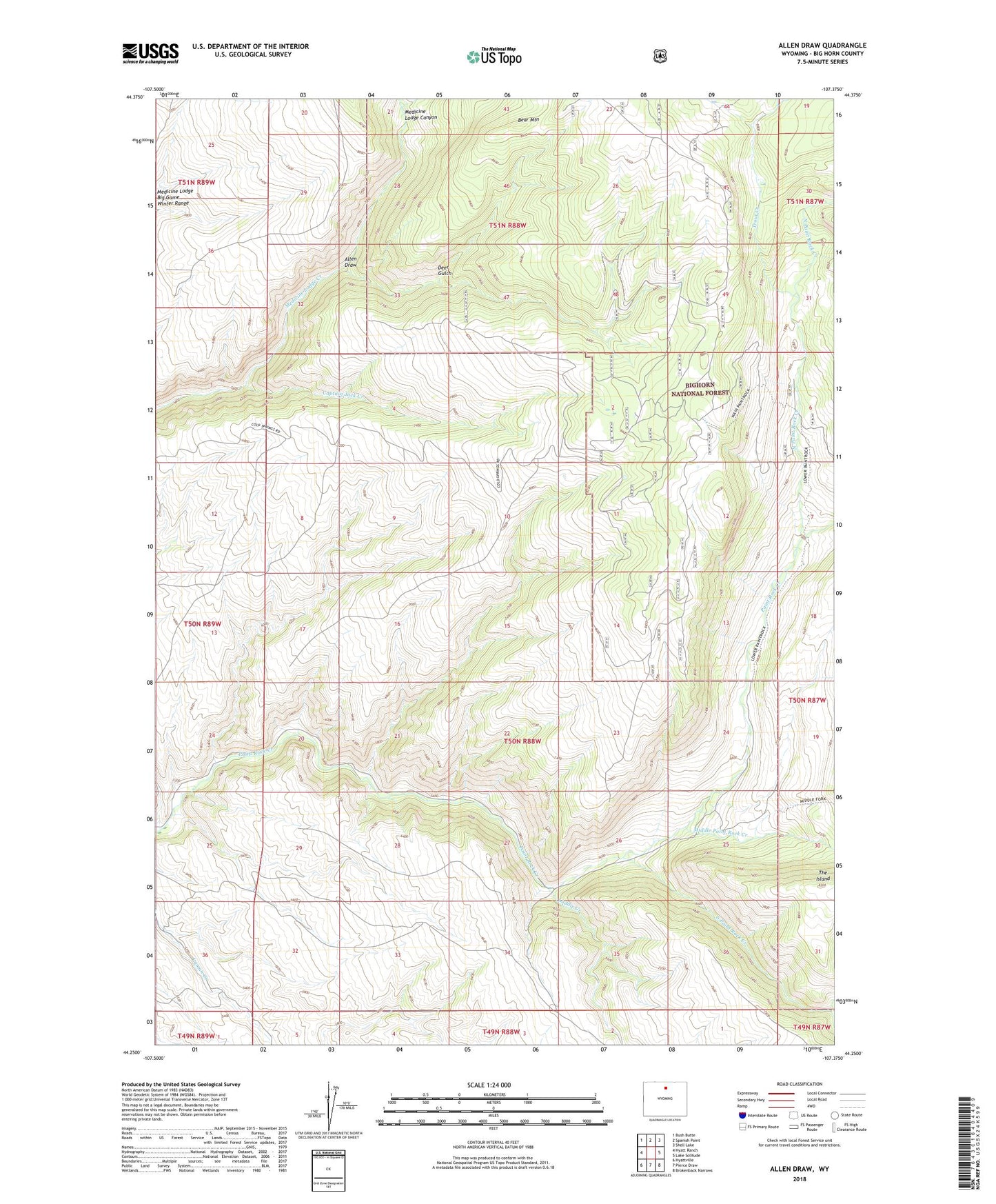
Allen Draw Wyoming US Topo Map
Couldn't load pickup availability
Also explore the Allen Draw Forest Service Topo of this same quad for updated USFS data
2021 topographic map quadrangle Allen Draw in the state of Wyoming. Scale: 1:24000. Based on the newly updated USGS 7.5' US Topo map series, this map is in the following counties: Big Horn. The map contains contour data, water features, and other items you are used to seeing on USGS maps, but also has updated roads and other features. This is the next generation of topographic maps. Printed on high-quality waterproof paper with UV fade-resistant inks.
Quads adjacent to this one:
West: Hyatt Ranch
Northwest: Bush Butte
North: Spanish Point
Northeast: Shell Lake
East: Lake Solitude
Southeast: Brokenback Narrows
South: Pierce Draw
Southwest: Hyattville
This map covers the same area as the classic USGS quad with code o44107c4.
Contains the following named places: Allen Draw, Bear Mountain, Captain Jack Creek, Cold Springs Campground, Deer Gulch, Laddie Creek, Middle Paint Rock Creek, North Paint Rock Creek, Sheep Creek, South Paint Rock Creek, The Island, Trout Creek