MyTopo
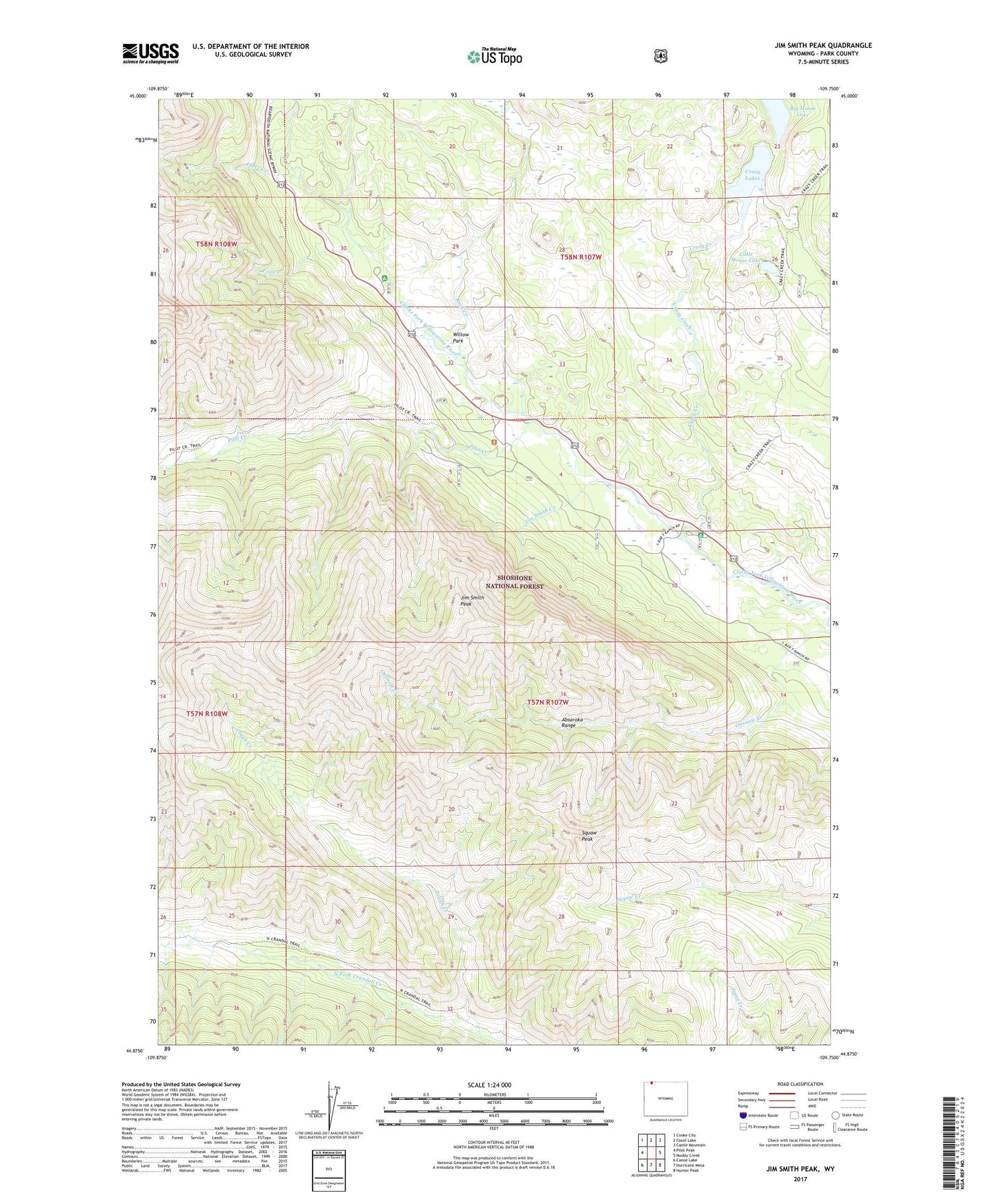
Jim Smith Peak Wyoming US Topo Map
Couldn't load pickup availability
Also explore the Jim Smith Peak Forest Service Topo of this same quad for updated USFS data
2023 topographic map quadrangle Jim Smith Peak in the state of Wyoming. Scale: 1:24000. Based on the newly updated USGS 7.5' US Topo map series, this map is in the following counties: Park. The map contains contour data, water features, and other items you are used to seeing on USGS maps, but also has updated roads and other features. This is the next generation of topographic maps. Printed on high-quality waterproof paper with UV fade-resistant inks.
Quads adjacent to this one:
West: Pilot Peak
Northwest: Cooke City
North: Fossil Lake
Northeast: Castle Mountain
East: Muddy Creek
Southeast: Hunter Peak
South: Hurricane Mesa
Southwest: Canoe Lake
This map covers the same area as the classic USGS quad with code o44109h7.
Contains the following named places: B Four Ranch, Bugle Lake, Crazy Creek, Crazy Creek Campground, Crazy Lakes, Crazy Lakes Trail, Fox Creek, Fox Creek Campground, Index Creek, Ivy Lake, Jim Smith Creek, Jim Smith Peak, Little Moose Lake, North Crandall Trail, Pilot Creek, Pilot Creek Trail, R D S Ranch, Rock Creek, Squaw Peak, Tough Creek, Willow Park