MyTopo
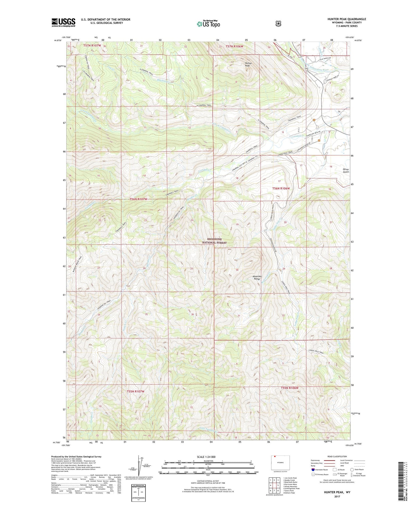
Hunter Peak Wyoming US Topo Map
Couldn't load pickup availability
Also explore the Hunter Peak Forest Service Topo of this same quad for updated USFS data
2023 topographic map quadrangle Hunter Peak in the state of Wyoming. Scale: 1:24000. Based on the newly updated USGS 7.5' US Topo map series, this map is in the following counties: Park. The map contains contour data, water features, and other items you are used to seeing on USGS maps, but also has updated roads and other features. This is the next generation of topographic maps. Printed on high-quality waterproof paper with UV fade-resistant inks.
Quads adjacent to this one:
West: Hurricane Mesa
Northwest: Jim Smith Peak
North: Muddy Creek
Northeast: Beartooth Butte
East: Windy Mountain
Southeast: Elkhorn Peak
South: Geers Point
Southwest: Stinkingwater Peak
This map covers the same area as the classic USGS quad with code o44109g6.
Contains the following named places: Blacktail Creek, Cary Pit, Cow Creek, Crandall Cutoff Trail, Crandall Ranger Station, Ghost Creek, Hoodoo Creek, Hunter Peak, Lodge Pole Creek, Lodgepole Trail, North Crandall Trailhead, North Fork Crandall Creek, Orr Ranch, Temple Creek, Wolverine Creek