MyTopo
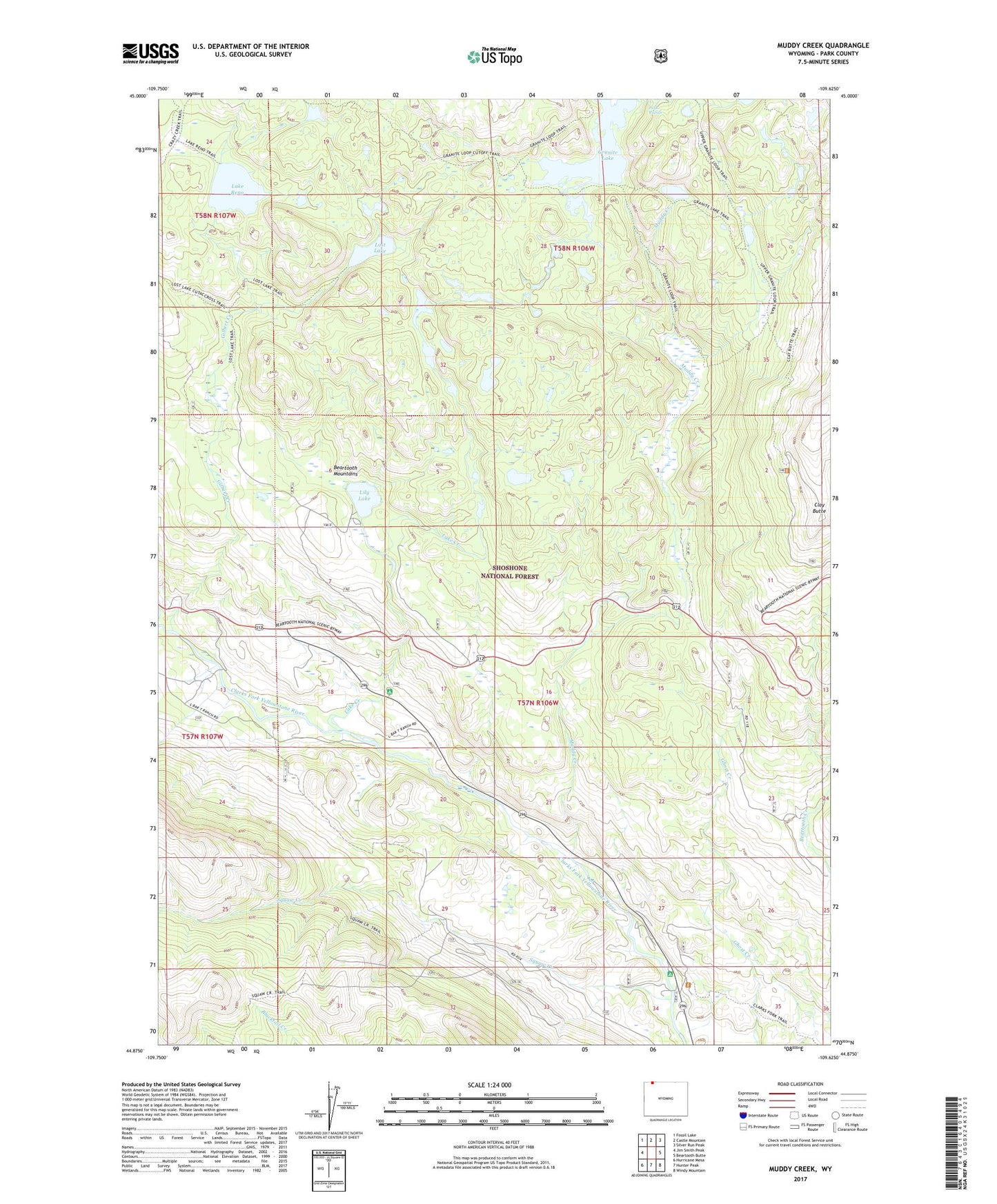
Muddy Creek Wyoming US Topo Map
Couldn't load pickup availability
Also explore the Muddy Creek Forest Service Topo of this same quad for updated USFS data
2023 topographic map quadrangle Muddy Creek in the state of Wyoming. Scale: 1:24000. Based on the newly updated USGS 7.5' US Topo map series, this map is in the following counties: Park. The map contains contour data, water features, and other items you are used to seeing on USGS maps, but also has updated roads and other features. This is the next generation of topographic maps. Printed on high-quality waterproof paper with UV fade-resistant inks.
Quads adjacent to this one:
West: Jim Smith Peak
Northwest: Fossil Lake
North: Castle Mountain
Northeast: Silver Run Peak
East: Beartooth Butte
Southeast: Windy Mountain
South: Hunter Peak
Southwest: Hurricane Mesa
This map covers the same area as the classic USGS quad with code o44109h6.
Contains the following named places: Clarks Fork Trailhead, Clay Butte, Clay Butte Trail, Copeland Lake Trail, Crazy Mountain Trail, Crossbow Ranch, Few Acres Ranch, Gilbert Creek, Granite Lake, Granite Loop Trail, Hunter Peak Campground, Hunter Peak Ranch, L Bar Ranch, Lake Creek, Lake Creek Campground, Lake Reno, Lake Reno Trail, Lily Lake, Lost Lake, Lost Lake Trail, Muddy Creek, Onemile Creek, Park Rapids, Squaw Creek, Squaw Creek Trail, State Highway Maintenance Camp, Upper Granite Loop Trail