MyTopo
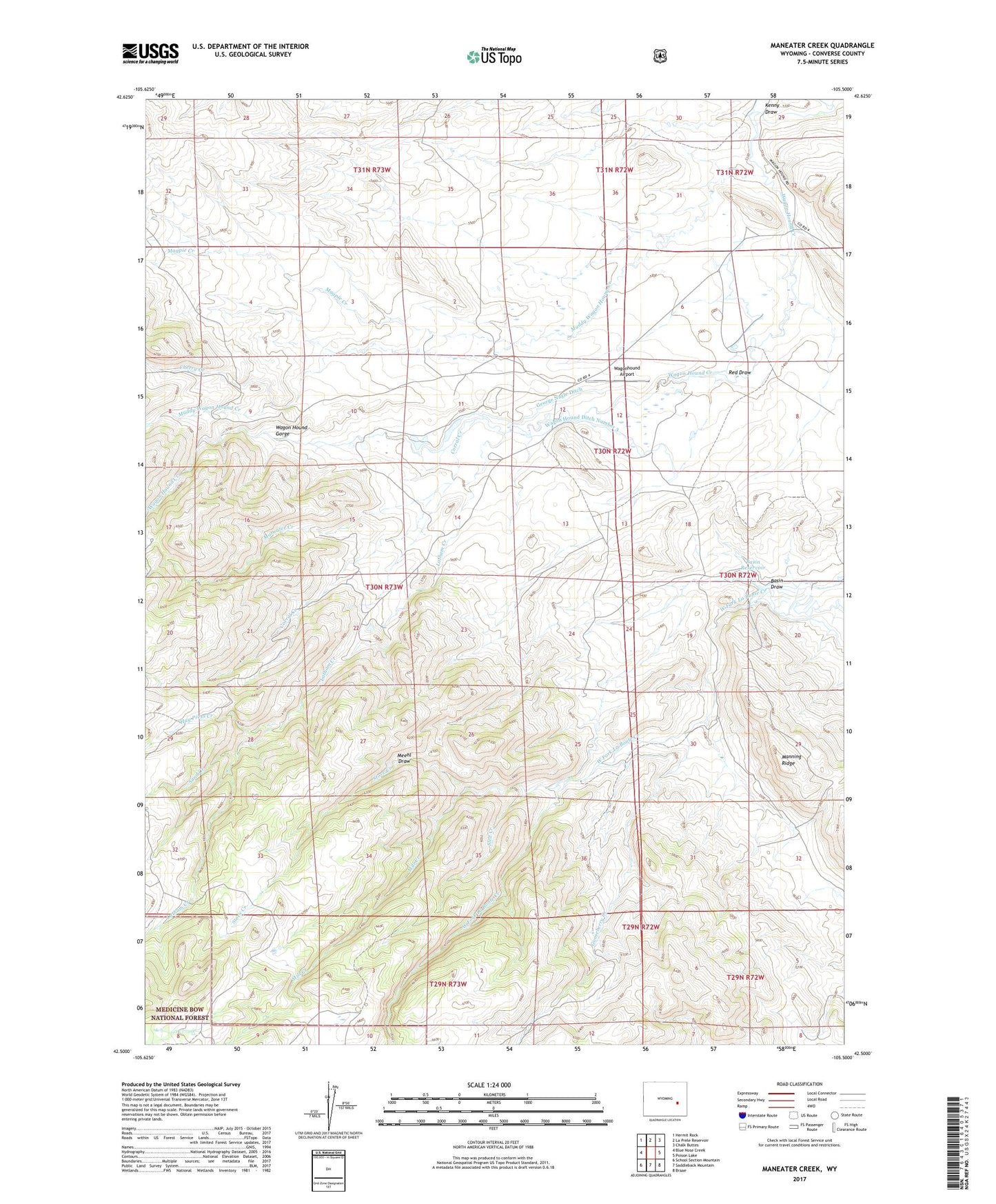
Maneater Creek Wyoming US Topo Map
Couldn't load pickup availability
Also explore the Maneater Creek Forest Service Topo of this same quad for updated USFS data
2021 topographic map quadrangle Maneater Creek in the state of Wyoming. Scale: 1:24000. Based on the newly updated USGS 7.5' US Topo map series, this map is in the following counties: Converse. The map contains contour data, water features, and other items you are used to seeing on USGS maps, but also has updated roads and other features. This is the next generation of topographic maps. Printed on high-quality waterproof paper with UV fade-resistant inks.
Quads adjacent to this one:
West: Blue Nose Creek
Northwest: Hermit Rock
North: La Prele Reservoir
Northeast: Chalk Buttes
East: Poison Lake
Southeast: Braae
South: Saddleback Mountain
Southwest: School Section Mountain
This map covers the same area as the classic USGS quad with code o42105e5.
Contains the following named places: Basin Dam, Basin Draw, Basin Reservoir, Cherry Creek, Corral Creek, George Nagle Ditch, Gooseberry Creek, Hay Press Creek, Kenny Draw, Latham Creek, Magpie Creek, Maneater Creek, Meehl Draw, Middleton Ranch, Mill Creek, Muddy Wagon Hound Creek, Peterson Dam, Peterson Reservoir, Raeber Ranch, Red Draw, Rogers Place, Sand Creek, Sled Creek, Stove Creek, Wagon Hound Ditch Number 3, Wagonhound Airport, West Fork La Bonte Creek