MyTopo
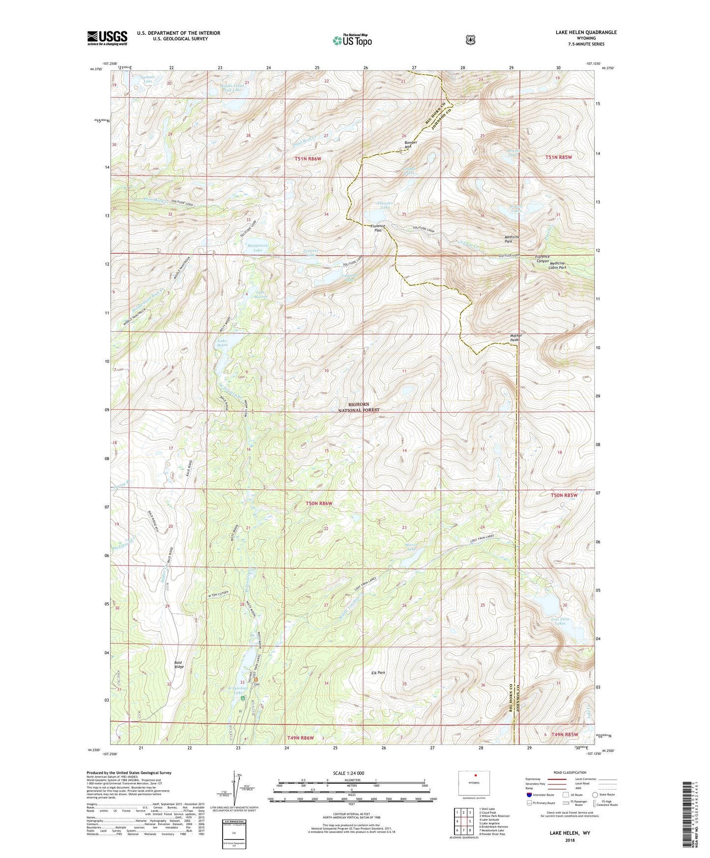
Lake Helen Wyoming US Topo Map
Couldn't load pickup availability
2021 topographic map quadrangle Lake Helen in the state of Wyoming. Scale: 1:24000. Based on the newly updated USGS 7.5' US Topo map series, this map is in the following counties: Big Horn, Johnson. The map contains contour data, water features, and other items you are used to seeing on USGS maps, but also has updated roads and other features. This is the next generation of topographic maps. Printed on high-quality waterproof paper with UV fade-resistant inks.
Quads adjacent to this one:
West: Lake Solitude
Northwest: Shell Lake
North: Cloud Peak
Northeast: Willow Park Reservoir
East: Lake Angeline
Southeast: Powder River Pass
South: Meadowlark Lake
Southwest: Brokenback Narrows
Contains the following named places: Bald Ridge, Bomber Mountain, Elk Park, Florence Canyon, Florence Lake, Florence Pass, Fortress Lakes, Golden Lakes, Gunboat Lake, Lake Helen, Lake Marion, Lost Twin Lakes, Mather Peaks, Medicine Cabin Park, Medicine Park, Middle Cloud Peak Lake, Mirror Lake, Mistymoon Lake, Mistymoon Trail, Powell Creek, Powell Lakes, Summit Lake, West Tensleep Campground, West Tensleep Lake