MyTopo
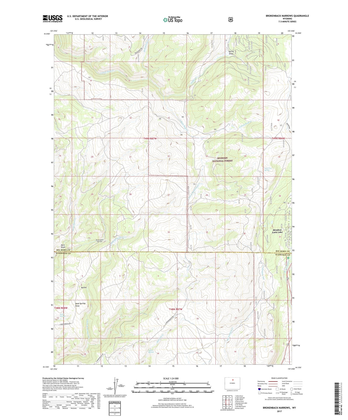
Brokenback Narrows Wyoming US Topo Map
Couldn't load pickup availability
Also explore the Brokenback Narrows Forest Service Topo of this same quad for updated USFS data
2021 topographic map quadrangle Brokenback Narrows in the state of Wyoming. Scale: 1:24000. Based on the newly updated USGS 7.5' US Topo map series, this map is in the following counties: Big Horn, Washakie. The map contains contour data, water features, and other items you are used to seeing on USGS maps, but also has updated roads and other features. This is the next generation of topographic maps. Printed on high-quality waterproof paper with UV fade-resistant inks.
Quads adjacent to this one:
West: Pierce Draw
Northwest: Allen Draw
North: Lake Solitude
Northeast: Lake Helen
East: Meadowlark Lake
Southeast: Onion Gulch
South: Old Maid Gulch
Southwest: Ten Sleep
This map covers the same area as the classic USGS quad with code o44107b3.
Contains the following named places: Boulder Park Campground, Brokenback Narrows, Buckskin Ed Creek, Buttes, Dorn Draw, East Tensleep Creek, Lone Tree Spring, Markham Draw, Meadow Lark Lake, Sand Springs, Soldier Creek, Soldier Creek Camp, Soldier Creek Prospect, Spring Draw, Tyrrell Ranger Station, West Tensleep Creek, Willow Springs