MyTopo
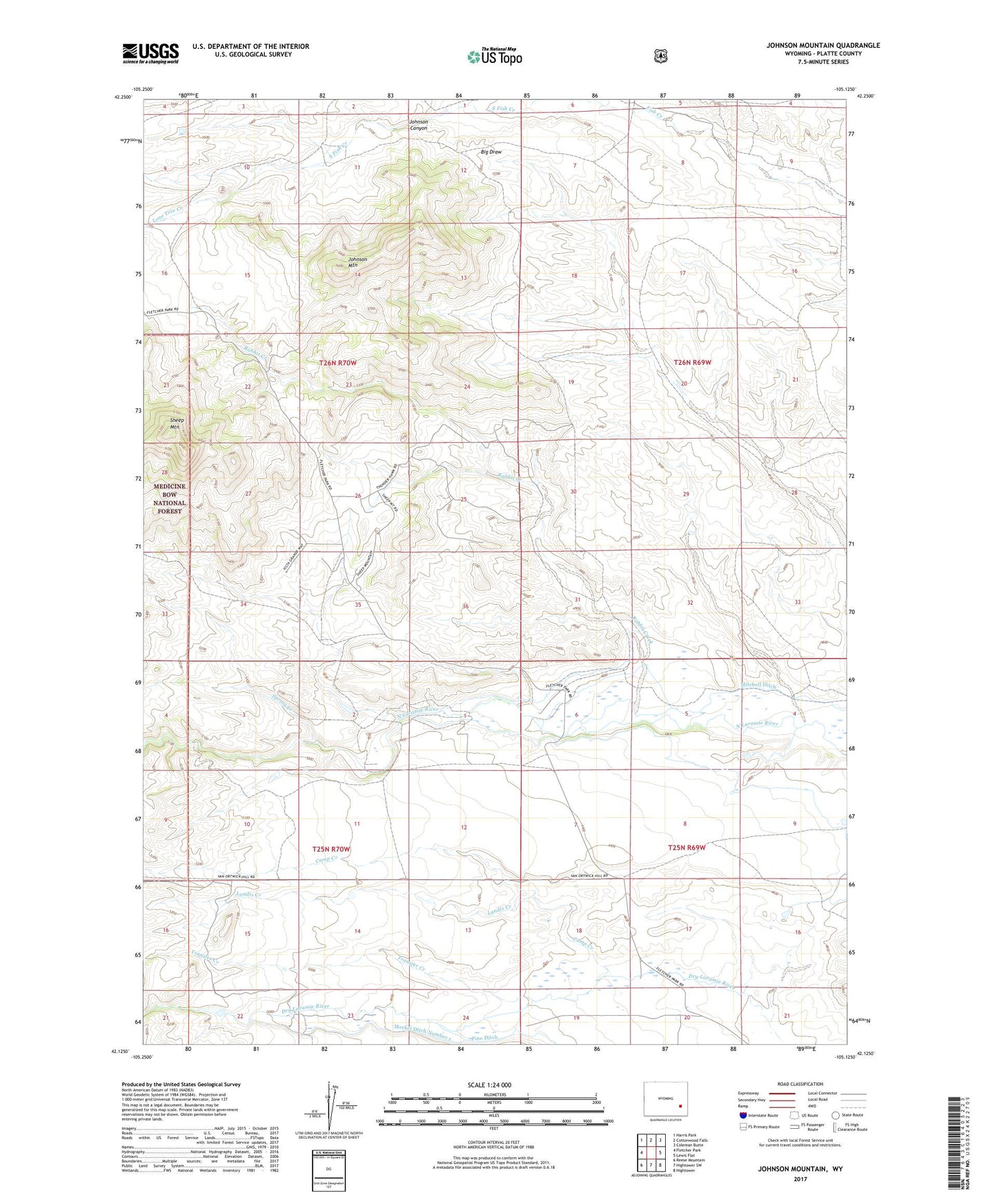
Johnson Mountain Wyoming US Topo Map
Couldn't load pickup availability
Also explore the Johnson Mountain Forest Service Topo of this same quad for updated USFS data
2021 topographic map quadrangle Johnson Mountain in the state of Wyoming. Scale: 1:24000. Based on the newly updated USGS 7.5' US Topo map series, this map is in the following counties: Platte. The map contains contour data, water features, and other items you are used to seeing on USGS maps, but also has updated roads and other features. This is the next generation of topographic maps. Printed on high-quality waterproof paper with UV fade-resistant inks.
Quads adjacent to this one:
West: Fletcher Park
Northwest: Harris Park
North: Cottonwood Falls
Northeast: Coleman Butte
East: Lewis Flat
Southeast: Hightower
South: Hightower SW
Southwest: Reese Mountain
This map covers the same area as the classic USGS quad with code o42105b2.
Contains the following named places: Black Powder Mines, Butner Ranch, Camp Creek, Devils Washtub, Hagemeister Ranch, Johnson Canyon, Johnson Mountain, Landis Creek, Lone Tree Creek, Merkel Ditch Number 1, Mitchell Ditch, Morrison Ranch, Rabbit Creek, Rabbit Creek Mine, Sheep Mountain, Sommers-Shockley School, Spring Creek, Tatman Ranch, Transfer Creek, Weaver Ranch