MyTopo
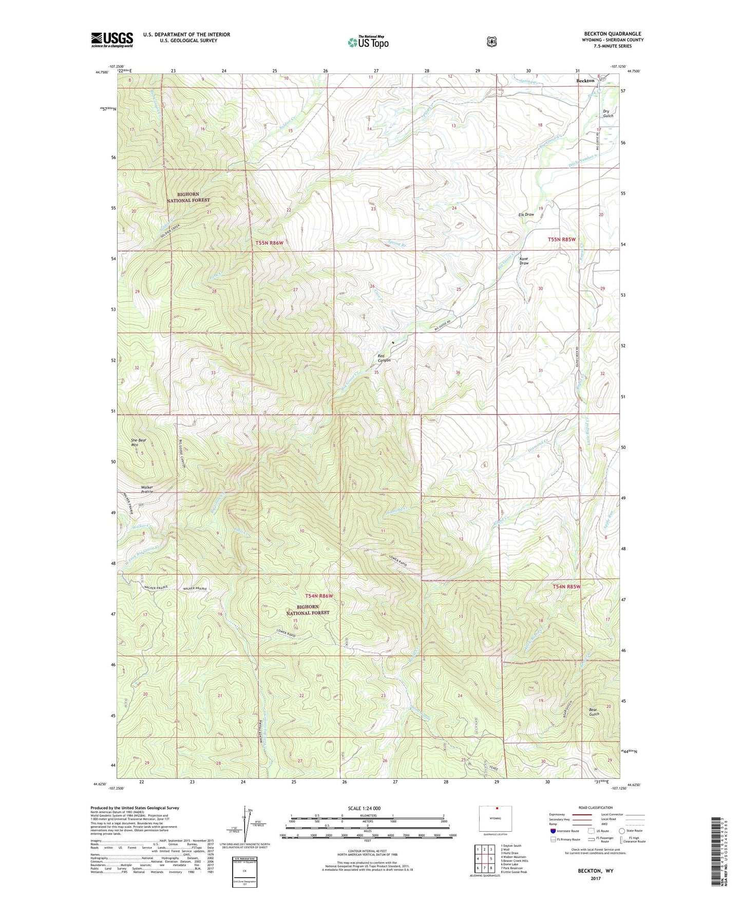
Beckton Wyoming US Topo Map
Couldn't load pickup availability
Also explore the Beckton Forest Service Topo of this same quad for updated USFS data
2021 topographic map quadrangle Beckton in the state of Wyoming. Scale: 1:24000. Based on the newly updated USGS 7.5' US Topo map series, this map is in the following counties: Sheridan. The map contains contour data, water features, and other items you are used to seeing on USGS maps, but also has updated roads and other features. This is the next generation of topographic maps. Printed on high-quality waterproof paper with UV fade-resistant inks.
Quads adjacent to this one:
West: Walker Mountain
Northwest: Dayton South
North: Wolf
Northeast: Hultz Draw
East: Beaver Creek Hills
Southeast: Little Goose Peak
South: Park Reservoir
Southwest: Dome Lake
This map covers the same area as the classic USGS quad with code o44107f2.
Contains the following named places: Bear Gulch Trail, Beckton, Carr Cabin, Cave Creek, Diamond Creek, Dry Gulch, East Fork Big Goose Creek, Elk Draw, Falls Creek, Kane Draw, Little Rapid Creek, Park Creek, Prairie Creek, Rapid Creek, Red Canyon, Sand Coulee, Sheridan Filtration Plant, Spring Branch, Spring Creek, Walker Creek, West Fork Big Goose Creek