MyTopo
Washakie Park Wyoming US Topo Map
Couldn't load pickup availability
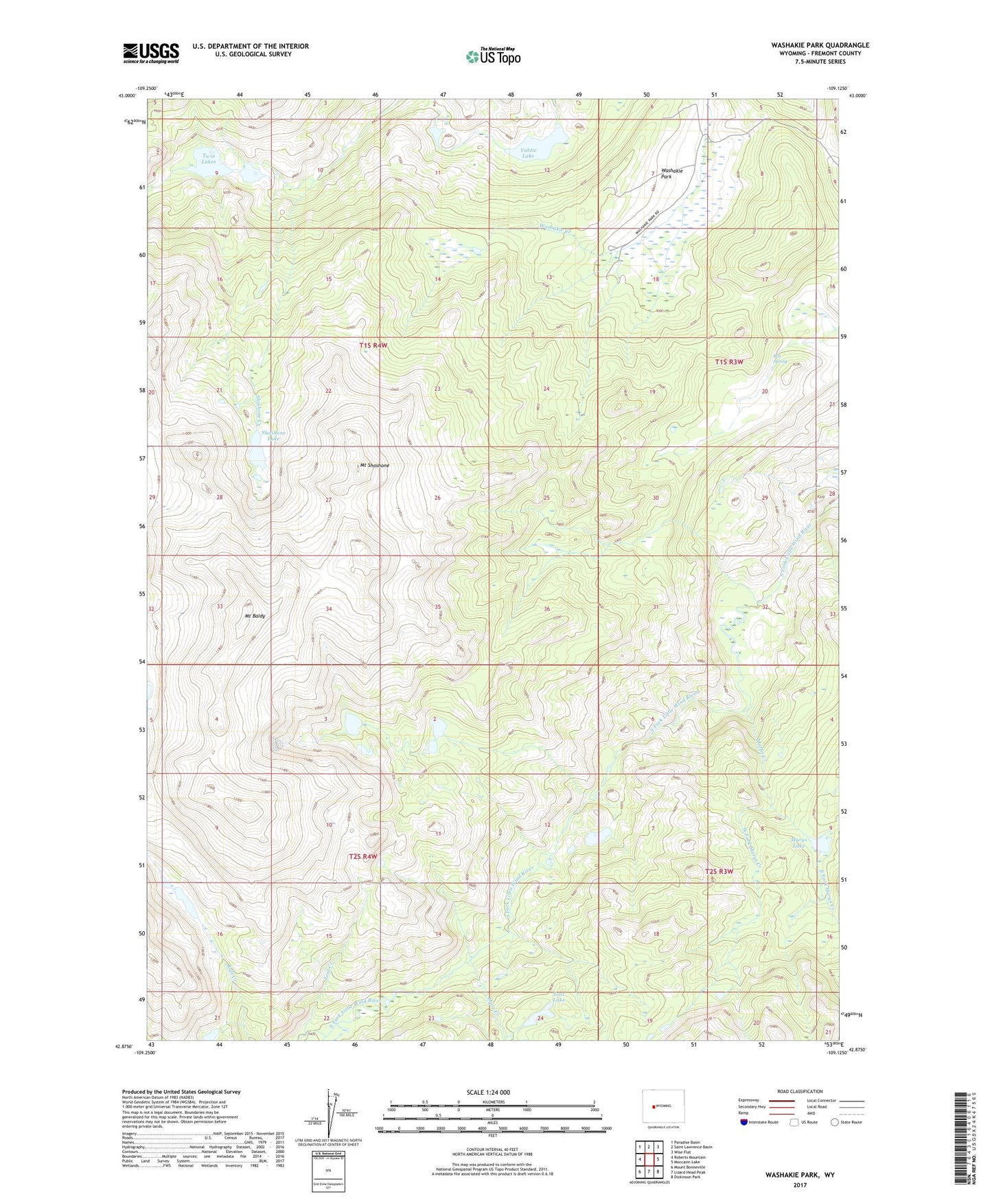
2021 topographic map quadrangle Washakie Park in the state of Wyoming. Scale: 1:24000. Based on the newly updated USGS 7.5' US Topo map series, this map is in the following counties: Fremont. The map contains contour data, water features, and other items you are used to seeing on USGS maps, but also has updated roads and other features. This is the next generation of topographic maps. Printed on high-quality waterproof paper with UV fade-resistant inks.
Quads adjacent to this one:
West: Roberts Mountain
Northwest: Paradise Basin
North: Saint Lawrence Basin
Northeast: Wise Flat
East: Moccasin Lake
Southeast: Dickinson Park
South: Lizard Head Peak
Southwest: Mount Bonneville
This map covers the same area as the classic USGS quad with code o42109h2.
Contains the following named places: Box Spring, East Fork Marys Creek, Gaylord Creek, Lost Creek, Lost Lake, Marys Creek, Marys Lake, Moss Creek, Mount Baldy, Mount Shoshone, Shoshone Creek, Shoshone Lake, Twin Lakes, Washakie Park, West Fork Marys Creek, Yahtic Lake