MyTopo
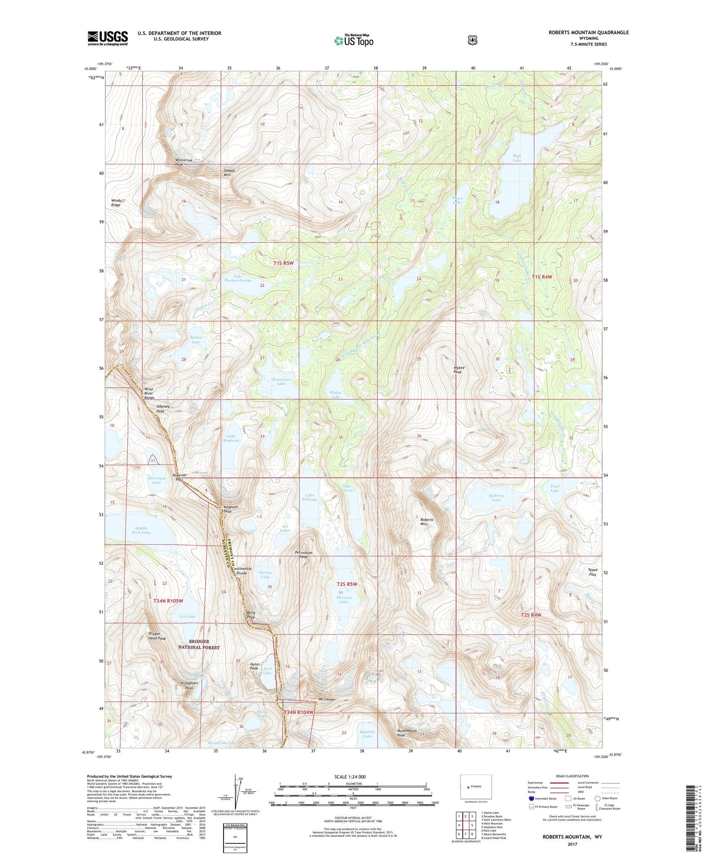
Roberts Mountain Wyoming US Topo Map
Couldn't load pickup availability
Also explore the Roberts Mountain Forest Service Topo of this same quad for updated USFS data
2021 topographic map quadrangle Roberts Mountain in the state of Wyoming. Scale: 1:24000. Based on the newly updated USGS 7.5' US Topo map series, this map is in the following counties: Fremont, Sublette. The map contains contour data, water features, and other items you are used to seeing on USGS maps, but also has updated roads and other features. This is the next generation of topographic maps. Printed on high-quality waterproof paper with UV fade-resistant inks.
Quads adjacent to this one:
West: Halls Mountain
Northwest: Alpine Lake
North: Paradise Basin
Northeast: Saint Lawrence Basin
East: Washakie Park
Southeast: Lizard Head Peak
South: Mount Bonneville
Southwest: Raid Lake
This map covers the same area as the classic USGS quad with code o42109h3.
Contains the following named places: Baily Peak, Bewmark Lake, Darren Lake, Dragon Head Peak, Entigo Creek, Fremont Trail, Glacier Creek, Ice Lakes, Kagevah Pass, Kagevah Peak, Lake Donna, Lake Heebeecheeche, Lake Kagevah, Lake Polaris, Lake Solitude, Lee Lake, Middle Fork Lake, Moraine Lake, Mount Lander, Movo Lake, Musembeah Peak, Noel Lake, Nylon Peak, Odyssey Peak, Petroleum Peak, Pronghorn Peak, Raft Lake, Roberts Lake, Roberts Mountain, Saddle Mountain, Shelia Lake, Sonnicant Lake, Spider Lake, Tepee Pass, Trail Lake, Twenty Lakes Creek, Wilson Creek, Wind River Roadless Area, Windy Ridge, Wolf Creek, Wolverine Peak, Wykee Lake, Wykee Peak