MyTopo
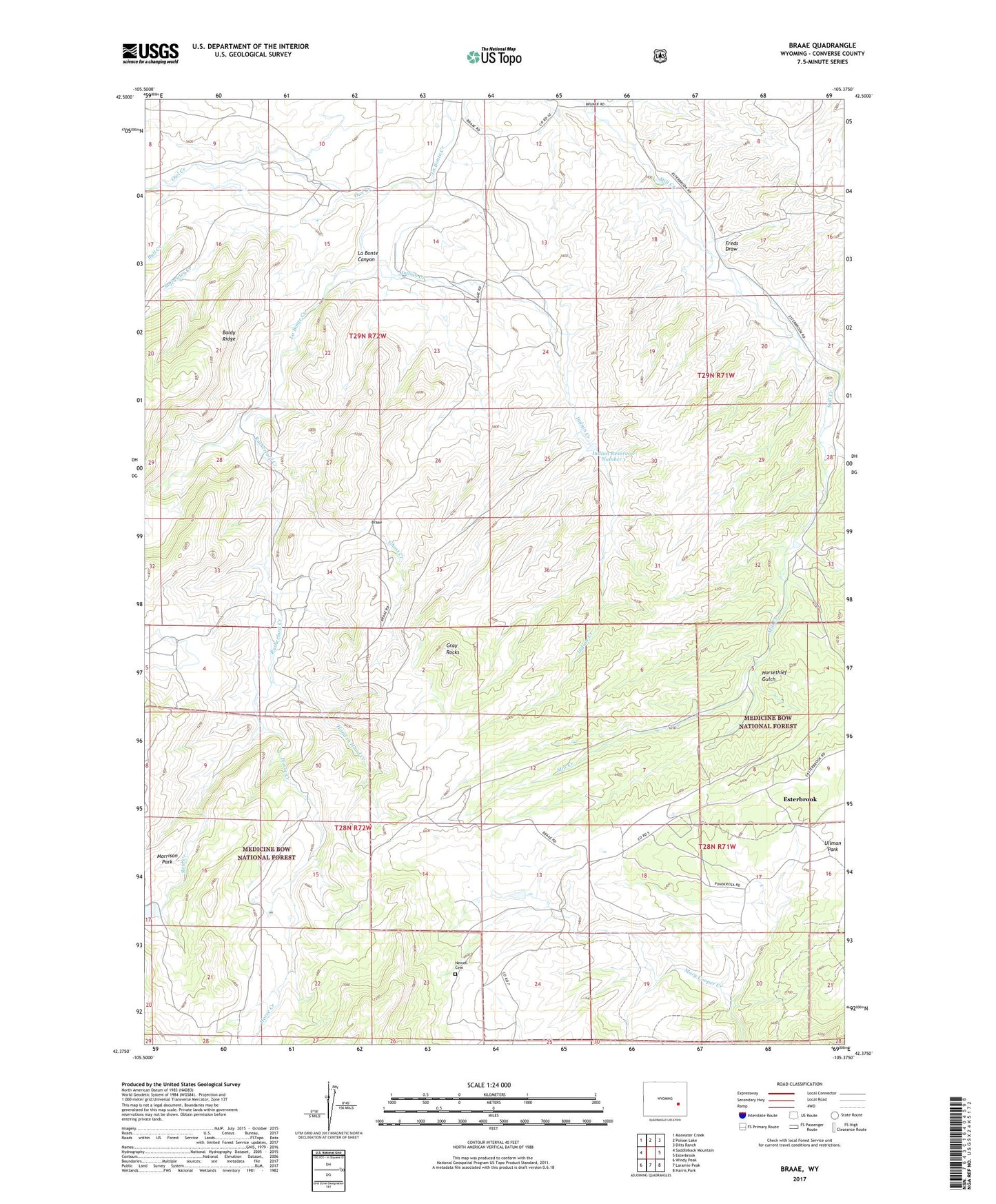
Braae Wyoming US Topo Map
Couldn't load pickup availability
Also explore the Braae Forest Service Topo of this same quad for updated USFS data
2021 topographic map quadrangle Braae in the state of Wyoming. Scale: 1:24000. Based on the newly updated USGS 7.5' US Topo map series, this map is in the following counties: Converse. The map contains contour data, water features, and other items you are used to seeing on USGS maps, but also has updated roads and other features. This is the next generation of topographic maps. Printed on high-quality waterproof paper with UV fade-resistant inks.
Quads adjacent to this one:
West: Saddleback Mountain
Northwest: Maneater Creek
North: Poison Lake
Northeast: Dilts Ranch
East: Esterbrook
Southeast: Harris Park
South: Laramie Peak
Southwest: Windy Peak
This map covers the same area as the classic USGS quad with code o42105d4.
Contains the following named places: Braae, Bull Creek, Cooper Ranch, Dunn Ranch, Dunn School, Esterbrook Census Designated Place, Freds Draw, Ghost Creek, Gray Rocks, Hand in Hand Creek, Horse Creek, Horsethief Gulch, Indian Creek, Indian Number 1 Dam, Indian Reservoir Number 1, La Bonte Canyon, La Bonte Ranch, Morton School, Newell Cemetery, Newell Ranch, Owl Creek, Pexton Number 1 Dam, Pexton Reservoir Number 1, Reid Creek, Rutherford Creek, Rutherford Ranch, Softwater Creek, Ullman Park