MyTopo
Mount Airy Wyoming US Topo Map
Couldn't load pickup availability
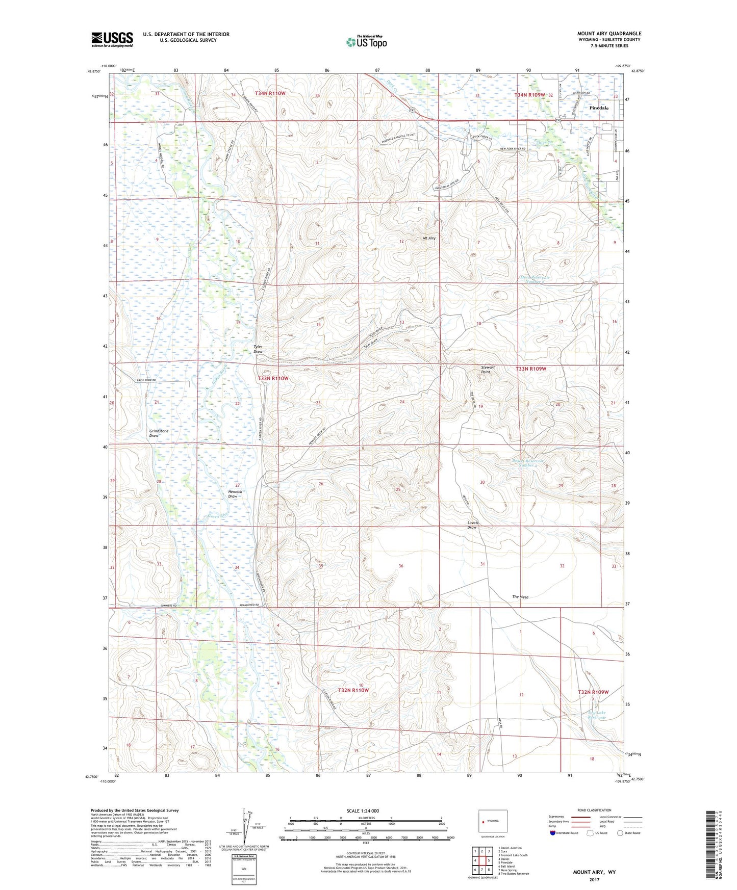
2021 topographic map quadrangle Mount Airy in the state of Wyoming. Scale: 1:24000. Based on the newly updated USGS 7.5' US Topo map series, this map is in the following counties: Sublette. The map contains contour data, water features, and other items you are used to seeing on USGS maps, but also has updated roads and other features. This is the next generation of topographic maps. Printed on high-quality waterproof paper with UV fade-resistant inks.
Quads adjacent to this one:
West: Daniel
Northwest: Daniel Junction
North: Cora
Northeast: Fremont Lake South
East: Pinedale
Southeast: Two Buttes Reservoir
South: Mesa Spring
Southwest: Ball Island
Contains the following named places: Ada Ditch, Basin Reservoir, Desert Reservoir Number 2, Dry Lake Reservoir, Duck Creek, Grindstone Draw, Grubbing Hoe Ranch, H Bar C Ranch, Hennick Draw, Mesa Reservoir Number 1, Mesa Reservoir Number 2, Mount Airy, Mount Airy Drift Fence, Poole Slough, Soap Hole Ditch, Sommers Ranch, Stewart Point, Sublette County, Tyler Draw, Wyoming Highway Patrol District 3 Division T