MyTopo
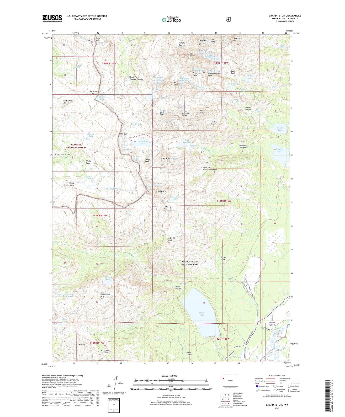
Grand Teton Wyoming US Topo Map
Couldn't load pickup availability
Also explore the Grand Teton Forest Service Topo of this same quad for updated USFS data
2021 topographic map quadrangle Grand Teton in the state of Wyoming. Scale: 1:24000. Based on the newly updated USGS 7.5' US Topo map series, this map is in the following counties: Teton. The map contains contour data, water features, and other items you are used to seeing on USGS maps, but also has updated roads and other features. This is the next generation of topographic maps. Printed on high-quality waterproof paper with UV fade-resistant inks.
Quads adjacent to this one:
West: Mount Bannon
Northwest: Granite Basin
North: Mount Moran
Northeast: Jenny Lake
East: Moose
Southeast: Gros Ventre Junction
South: Teton Village
Southwest: Rendezvous Peak
This map covers the same area as the classic USGS quad with code o43110f7.
Contains the following named places: Alaska Basin, Alaska Basin Trail, Albright Peak, Amphitheater Lake, Amphitheater Lake Trail, Avalanche Canyon, Bannock Falls, Basin Lakes, Battleship Mountain, Bradley Lake, Broken Falls, Buck Mountain, Cleft Falls, Cloudveil Dome, Coyote Lake, Death Canyon, Delta Lake, Disappointment Peak, East Prong, Forget-me-not Lakes, Garnet Canyon, Glacier Falls, Grand Teton, Hurricane Pass, Icefloe Lake, J Y Ranch, Kit Lake, Lake Taminah, Middle Teton, Middle Teton Glacier, Mount Hunt, Mount Hunt Divide, Mount Meek Pass, Mount Owen, Mount Wister, Nez Perce, Open Canyon, Open Canyon Trail, Phelps Lake, Prospectors Mountain, R Lazy S Ranch, Rimrock Lake, Schoolroom Glacier, Shadow Peak, Sheep Steps, Shoshoko Falls, Snowdrift Lake, South Fork, South Fork Avalanche Canyon, South Teton, Spalding Falls, Static Peak, Stewart Draw, Sunset Lake, Surprise Lake, Table Mountain, Taggart Lake, Teepe Glacier, Teepe Pillar, Teewinot Mountain, Teton Glacier, The Wall, Timberline Lake, Valley Trail, Veiled Peak, White Grass Ranch, White Grass Ranger Station, ZIP Code: 83012