MyTopo
Mount Schidler Wyoming US Topo Map
Couldn't load pickup availability
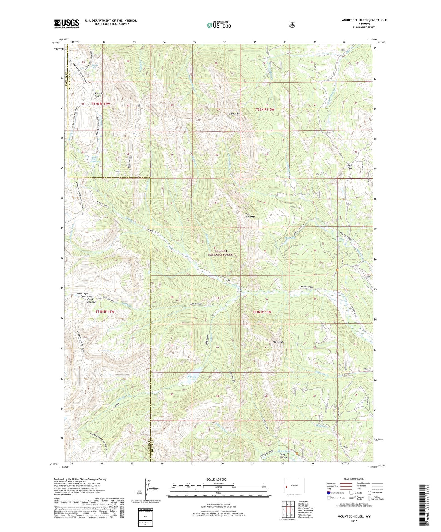
2021 topographic map quadrangle Mount Schidler in the state of Wyoming. Scale: 1:24000. Based on the newly updated USGS 7.5' US Topo map series, this map is in the following counties: Sublette, Lincoln. The map contains contour data, water features, and other items you are used to seeing on USGS maps, but also has updated roads and other features. This is the next generation of topographic maps. Printed on high-quality waterproof paper with UV fade-resistant inks.
Quads adjacent to this one:
West: Box Canyon Creek
Northwest: Park Creek
North: Triple Peak
Northeast: Maki Creek
East: Red Castle Creek
Southeast: Springman Creek
South: Wyoming Peak
Southwest: Poison Meadows
Contains the following named places: Bare Mountain, Bare Pass, Box Canyon Pass, Coal Mine Mountain, Crow Creek, Lake Creek, Lake Fork Creek, Long Hollow, Lunch Creek, Lunch Creek Meadows, Menace Falls, Mount Schidler, Mud Lake, North Piney Lake, North Piney Meadows, Pinion Creek, Roaring Fork, South Apperson Creek, South Fork Bare Creek, West Fork Bare Creek