MyTopo
Natural Trap Cave Wyoming US Topo Map
Couldn't load pickup availability
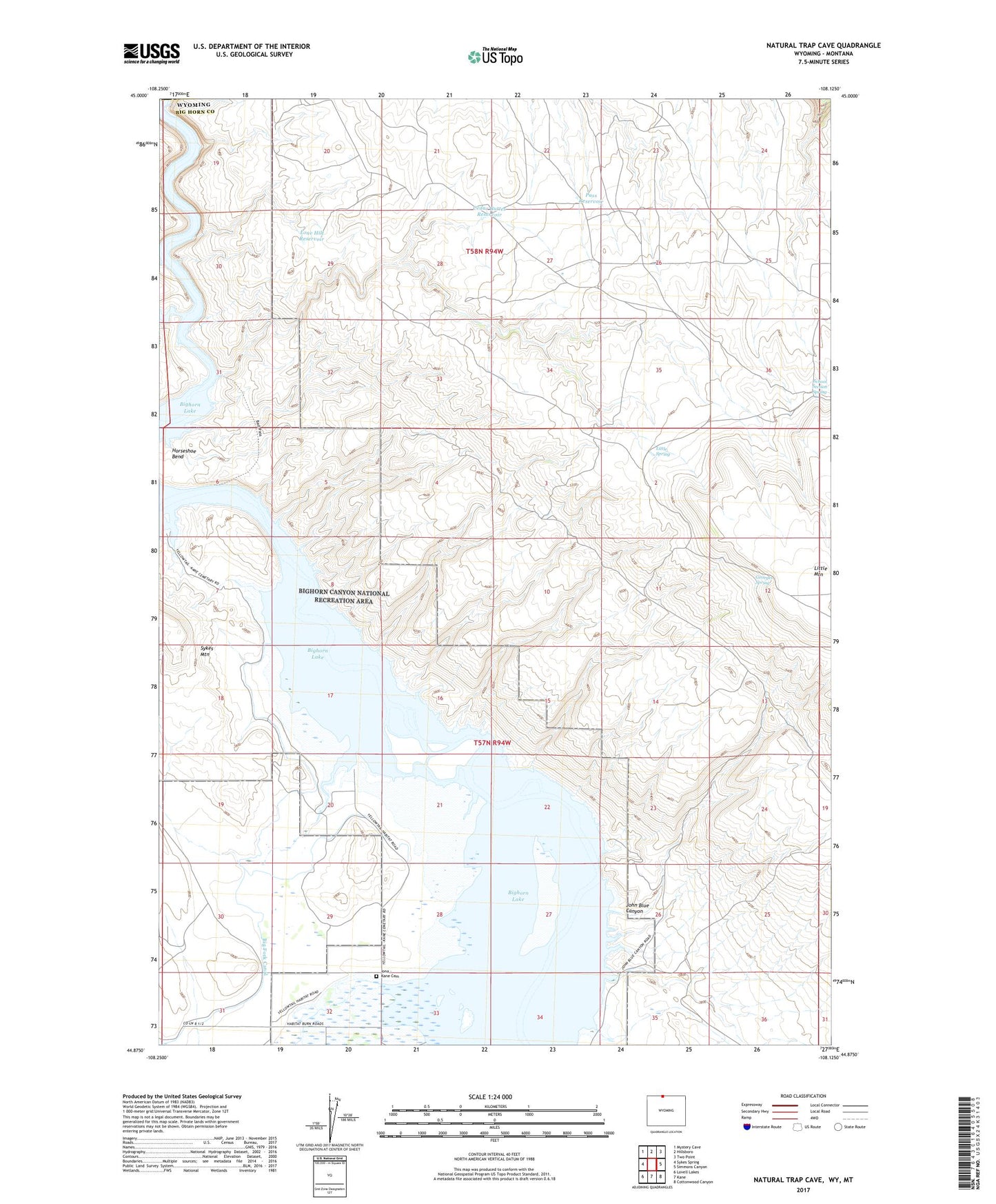
2021 topographic map quadrangle Natural Trap Cave in the state of Wyoming. Scale: 1:24000. Based on the newly updated USGS 7.5' US Topo map series, this map is in the following counties: Big Horn, Carbon. The map contains contour data, water features, and other items you are used to seeing on USGS maps, but also has updated roads and other features. This is the next generation of topographic maps. Printed on high-quality waterproof paper with UV fade-resistant inks.
Quads adjacent to this one:
West: Sykes Spring
Northwest: Mystery Cave
North: Hillsboro
Northeast: Two Point
East: Simmons Canyon
Southeast: Cottonwood Canyon
South: Kane
Southwest: Lovell Lakes
Contains the following named places: Avery Claims Mine, Big Fork Canal, Cave Group Mine, Cedar Buttes Reservoir, Dirty Beast Mine, Fuesner and Sons Mine, Georges Spring, Glory Hole, High Noon Claims Mine, High Noon Mine, Horseshoe Claim Number Nine Mine, Horseshoe Claims Number Ten Mine, Horseshoe Group Mine, Iona - Kane Cemetery, John Blue Canyon, John Claim Mine, Lisbon Mines, Little Mountain Mine, Little Spring, Lone Hill Reservoir, Mickey 2-10 Mine, Midnight Mine, Mike 1-10 Mine, Mike Number Ten Mine, Modern Mines Mine, Pass Reservoir, Saunders Mine, School Section Spring, Smith-Powleson Claim Mine, Super Cub Mine, The Narrows River, Titan Mine, Tri Pacer Number Five Mine, Tri Pacer Number Four Mine, Tri-pacer Number Four Mine, Western Bighorn Group Mine, Whitehead Claims Mine