MyTopo
Norris Junction Wyoming US Topo Map
Couldn't load pickup availability
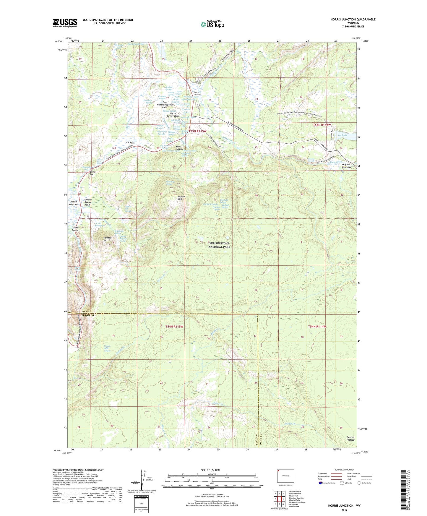
2021 topographic map quadrangle Norris Junction in the state of Wyoming. Scale: 1:24000. Based on the newly updated USGS 7.5' US Topo map series, this map is in the following counties: Park, Teton. The map contains contour data, water features, and other items you are used to seeing on USGS maps, but also has updated roads and other features. This is the next generation of topographic maps. Printed on high-quality waterproof paper with UV fade-resistant inks.
Quads adjacent to this one:
West: Madison Junction
Northwest: Mount Holmes
North: Obsidian Cliff
Northeast: Cook Peak
East: Crystal Falls
Southeast: Beach Lake
South: Mary Lake
Southwest: Lower Geyser Basin
This map covers the same area as the classic USGS quad with code o44110f6.
Contains the following named places: Artists Paintpots, Bathtub Spring, Beryl Spring, Big Alcove Spring, Black Growler, Chocolate Pots, Cistern Spring, Congress Pool, Constant Geyser, Corporal Geyser, Crater Hills Geyser, Duck Rock, Echinus Geyser, Elk Park, Emerald Spring, Fearless Geyser, Fenner Drill Hole, Geyser Creek, Geyser Springs Group, Gibbon Geyser Basin, Gibbon Hill, Gibbon Hill Geyser, Gibbon River Rapids, Gray Lakes, Horseshoe Spring, Howard Eaton Trail, Hurricane Vent, Ice Lake, Ice Lakes Trail, Medusa Spring, Minute Geyser, Monarch Geyser, New Crater Geyser, Norris Geyser Basin, Norris Junction, Norris Museum, Norris Ranger Station, Nuphar Lake, One Hundred Spring Plain, Paintpot Hill, Palpitator Spring, Pearl Geyser, Perpetual Spouter, Phillips Caldron, Porkchop Geyser, Realgar Creek, Realgar Spring, Realgar Springs, Scalloped Spring, Sieve Lake, Solfatara Creek, Steamboat Geyser, Tantalus Creek, Valentine Geyser, Virginia Cascade, Virginia Meadows, Vixen Geyser, Whirligig Geyser