MyTopo
Notches Dome Wyoming US Topo Map
Couldn't load pickup availability
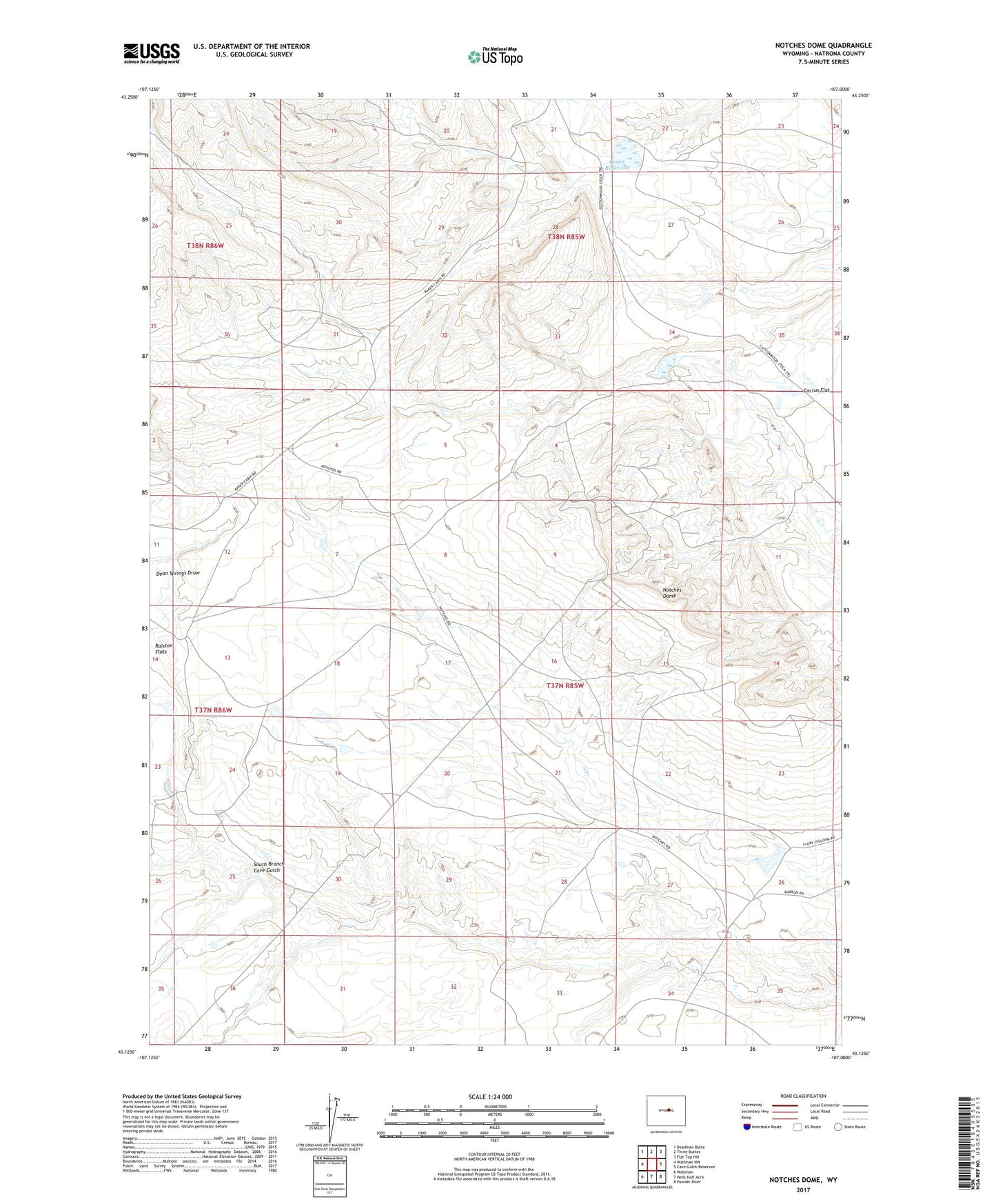
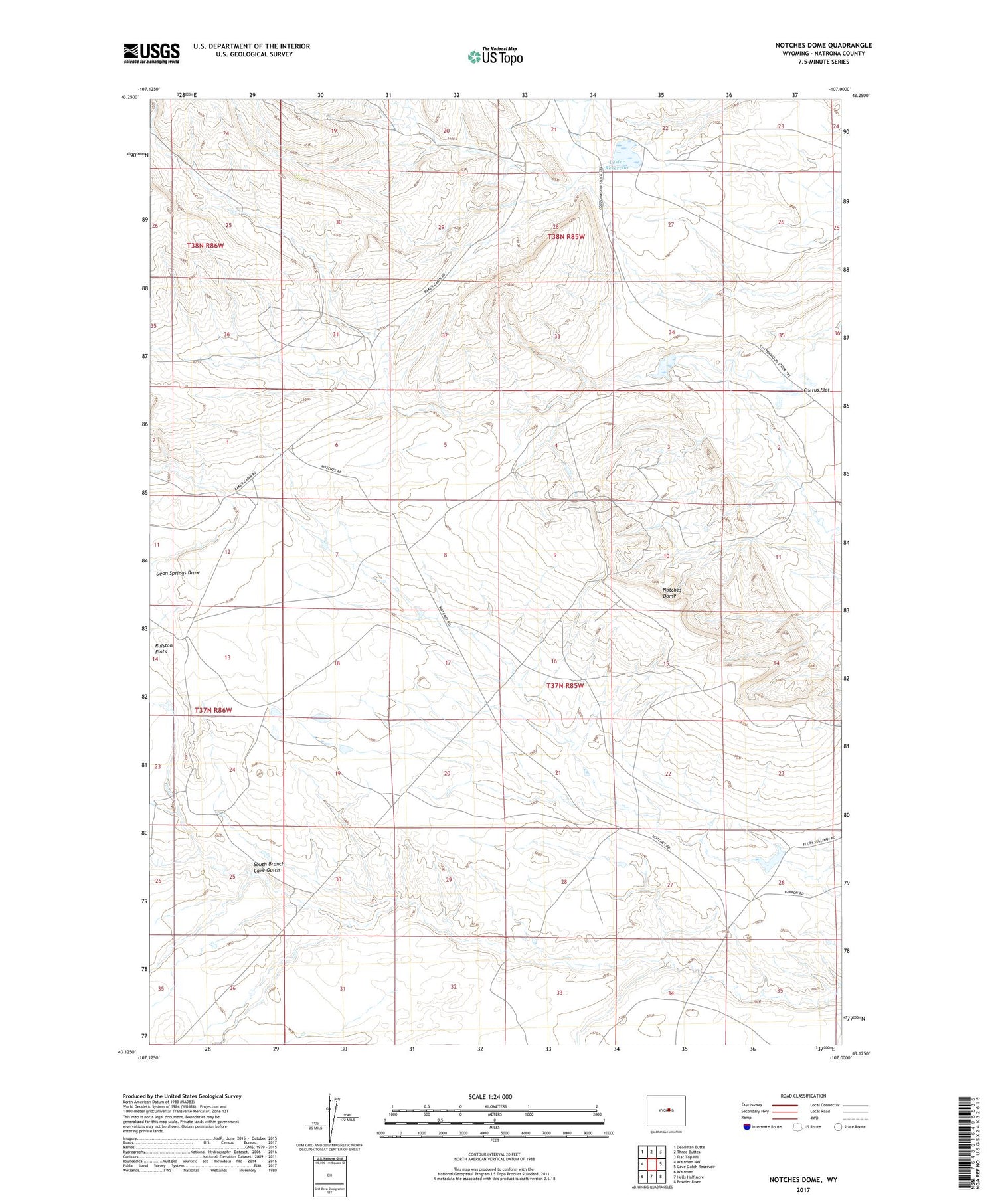
2021 topographic map quadrangle Notches Dome in the state of Wyoming. Scale: 1:24000. Based on the newly updated USGS 7.5' US Topo map series, this map is in the following counties: Natrona. The map contains contour data, water features, and other items you are used to seeing on USGS maps, but also has updated roads and other features. This is the next generation of topographic maps. Printed on high-quality waterproof paper with UV fade-resistant inks.
Quads adjacent to this one:
West: Waltman NW
Northwest: Deadman Butte
North: Three Buttes
Northeast: Flat Top Hill
East: Cave Gulch Reservoir
Southeast: Powder River
South: Hells Half Acre
Southwest: Waltman
Contains the following named places: Lester Dam, Lester Lake, Lester Reservoir, Notches Dome, South Branch Cave Gulch