MyTopo
Pacific Springs Wyoming US Topo Map
Couldn't load pickup availability
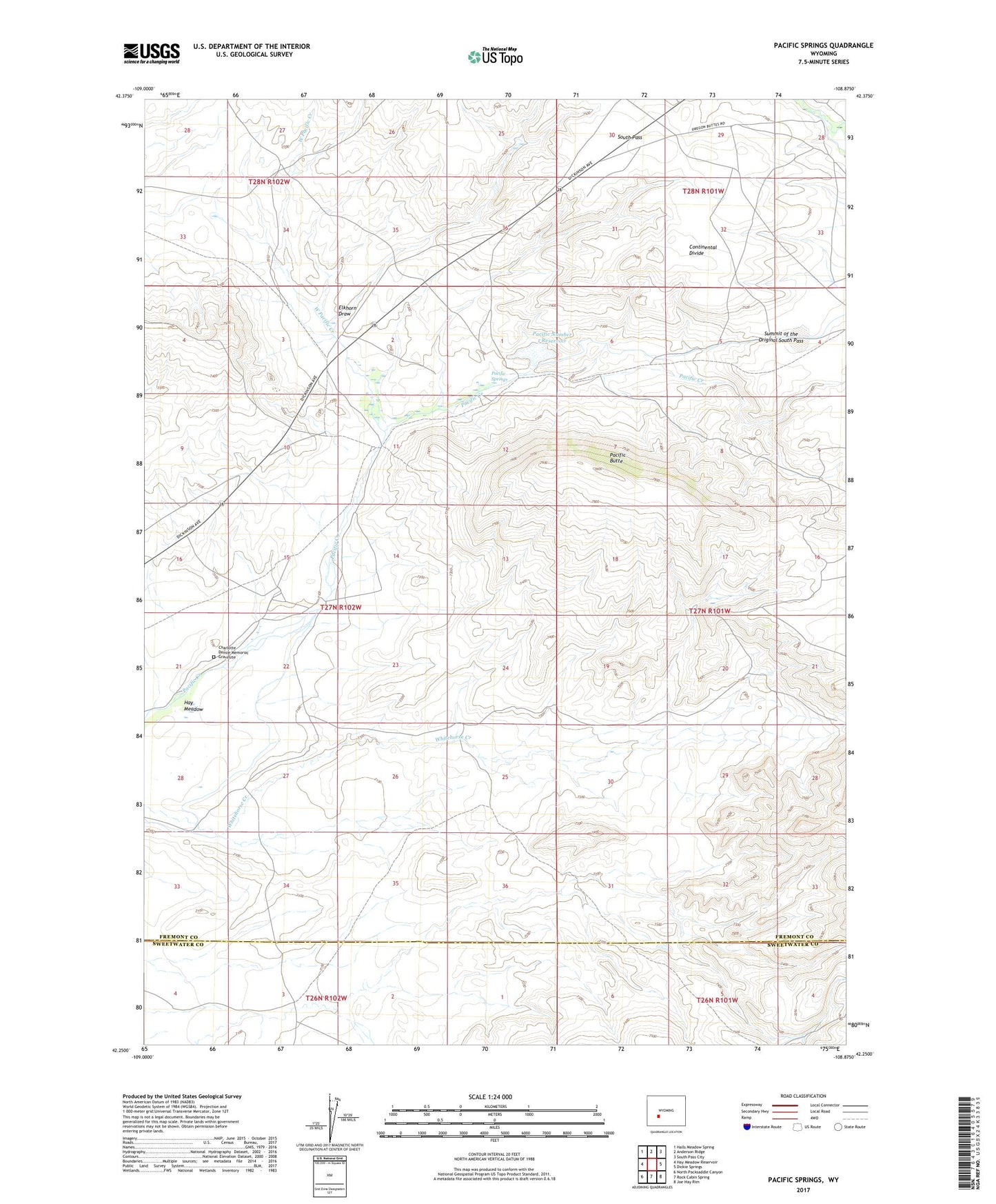
2021 topographic map quadrangle Pacific Springs in the state of Wyoming. Scale: 1:24000. Based on the newly updated USGS 7.5' US Topo map series, this map is in the following counties: Fremont, Sweetwater. The map contains contour data, water features, and other items you are used to seeing on USGS maps, but also has updated roads and other features. This is the next generation of topographic maps. Printed on high-quality waterproof paper with UV fade-resistant inks.
Quads adjacent to this one:
West: Hay Meadow Reservoir
Northwest: Halls Meadow Spring
North: Anderson Ridge
Northeast: South Pass City
East: Dickie Springs
Southeast: Joe Hay Rim
South: Rock Cabin Spring
Southwest: North Packsaddle Canyon
This map covers the same area as the classic USGS quad with code o42108c8.
Contains the following named places: Charlotte Dansie Memorial Gravesite, Elkhorn Draw, Hay Meadow, Old Halter and Flick Ranch, Pacific Butte, Pacific Butte Area Mine, Pacific Dam, Pacific Number 1 Reservoir, Pacific Springs, Pard Number Four Mine, South Pass, Stage and Pony Express Station Site, Summit of the Original South Pass, West Pacific Creek