MyTopo
Page Draw Wyoming US Topo Map
Couldn't load pickup availability
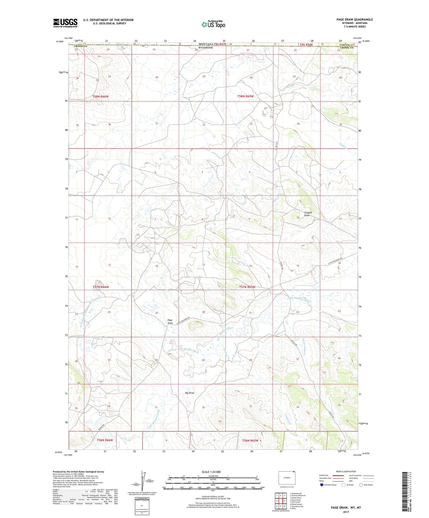
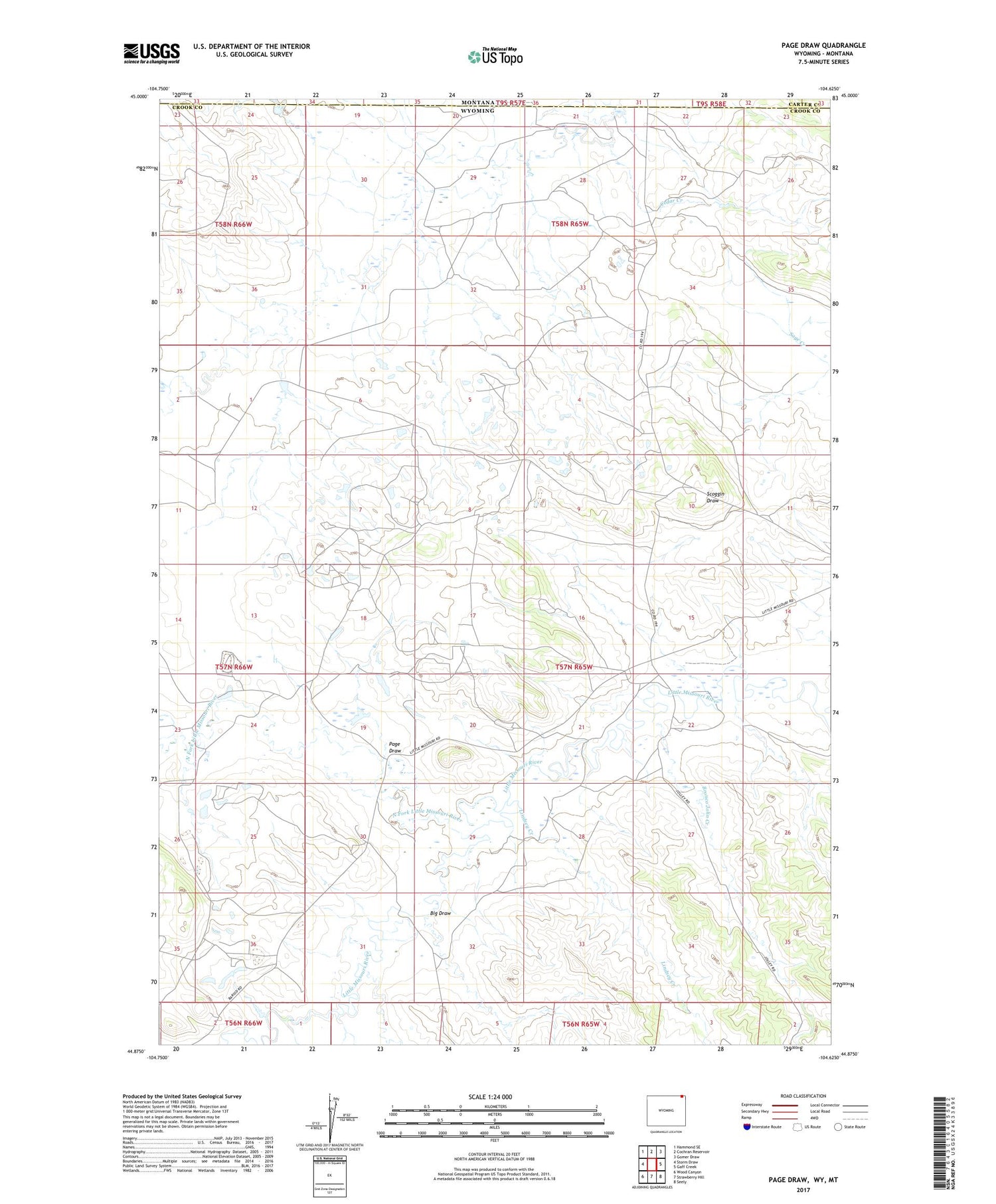
2021 topographic map quadrangle Page Draw in the state of Wyoming. Scale: 1:24000. Based on the newly updated USGS 7.5' US Topo map series, this map is in the following counties: Crook, Carter. The map contains contour data, water features, and other items you are used to seeing on USGS maps, but also has updated roads and other features. This is the next generation of topographic maps. Printed on high-quality waterproof paper with UV fade-resistant inks.
Quads adjacent to this one:
West: Storm Draw
Northwest: Hammond SE
North: Cochran Reservoir
Northeast: Gomer Draw
East: Gaff Creek
Southeast: Seely
South: Strawberry Hill
Southwest: Wood Canyon
Contains the following named places: Big Draw, Bronco John Creek, Bush Ranch Reservoir, Cedar Creek, Dewitt Ranch, Jackson Ranch, Kajan Diversion Dam, Kajan Diversion Reservoir, Lindsey Creek, Madden Ranch, Maurer Ranch, Missouri Mine, North Fork Little Missouri River, Page Draw, Thompson Creek