MyTopo
Cochran Reservoir Montana US Topo Map
Couldn't load pickup availability
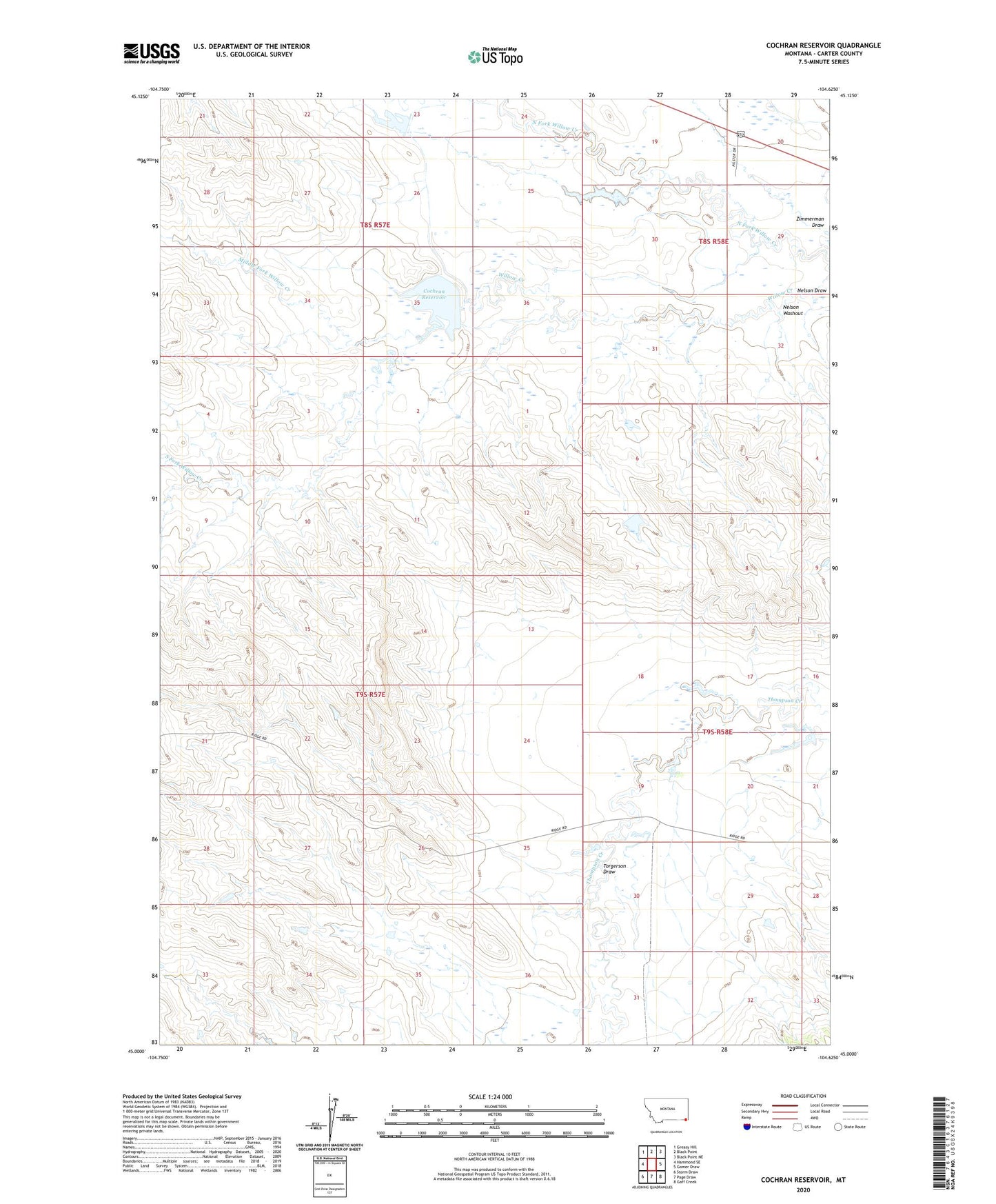
2024 topographic map quadrangle Cochran Reservoir in the state of Montana. Scale: 1:24000. Based on the newly updated USGS 7.5' US Topo map series, this map is in the following counties: Carter. The map contains contour data, water features, and other items you are used to seeing on USGS maps, but also has updated roads and other features. This is the next generation of topographic maps. Printed on high-quality waterproof paper with UV fade-resistant inks.
Quads adjacent to this one:
West: Hammond SE
Northwest: Greasy Hill
North: Black Point
Northeast: Black Point NE
East: Gomer Draw
Southeast: Gaff Creek
South: Page Draw
Southwest: Storm Draw
This map covers the same area as the classic USGS quad with code o45104a6.
Contains the following named places: 08S58E29BBBA01 Well, Cochran Reservoir, Cockran Grazing Number 1 Dam, Cockran Grazing Number 2 Dam, Cockran Grazing Number 3 Dam, Cockran Grazing Number 4 Dam, Middle Fork Willow Creek, Nelson Draw, Nelson Washout, North Fork Willow Creek, Pilister Diversion Dam, Pilister Number 1 Dam, South Fork Willow Creek, Torgerson Draw, Wyotana Ranch Number 4 Dam