MyTopo
Poe Mountain Wyoming US Topo Map
Couldn't load pickup availability
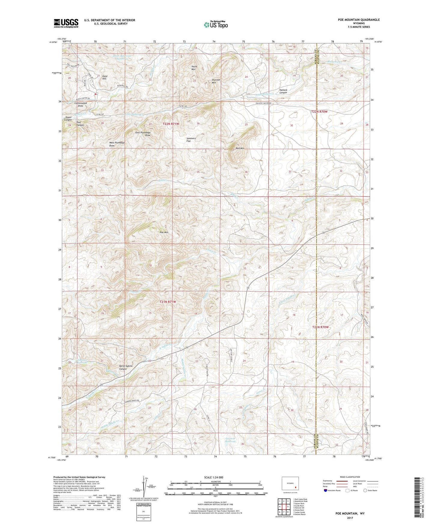
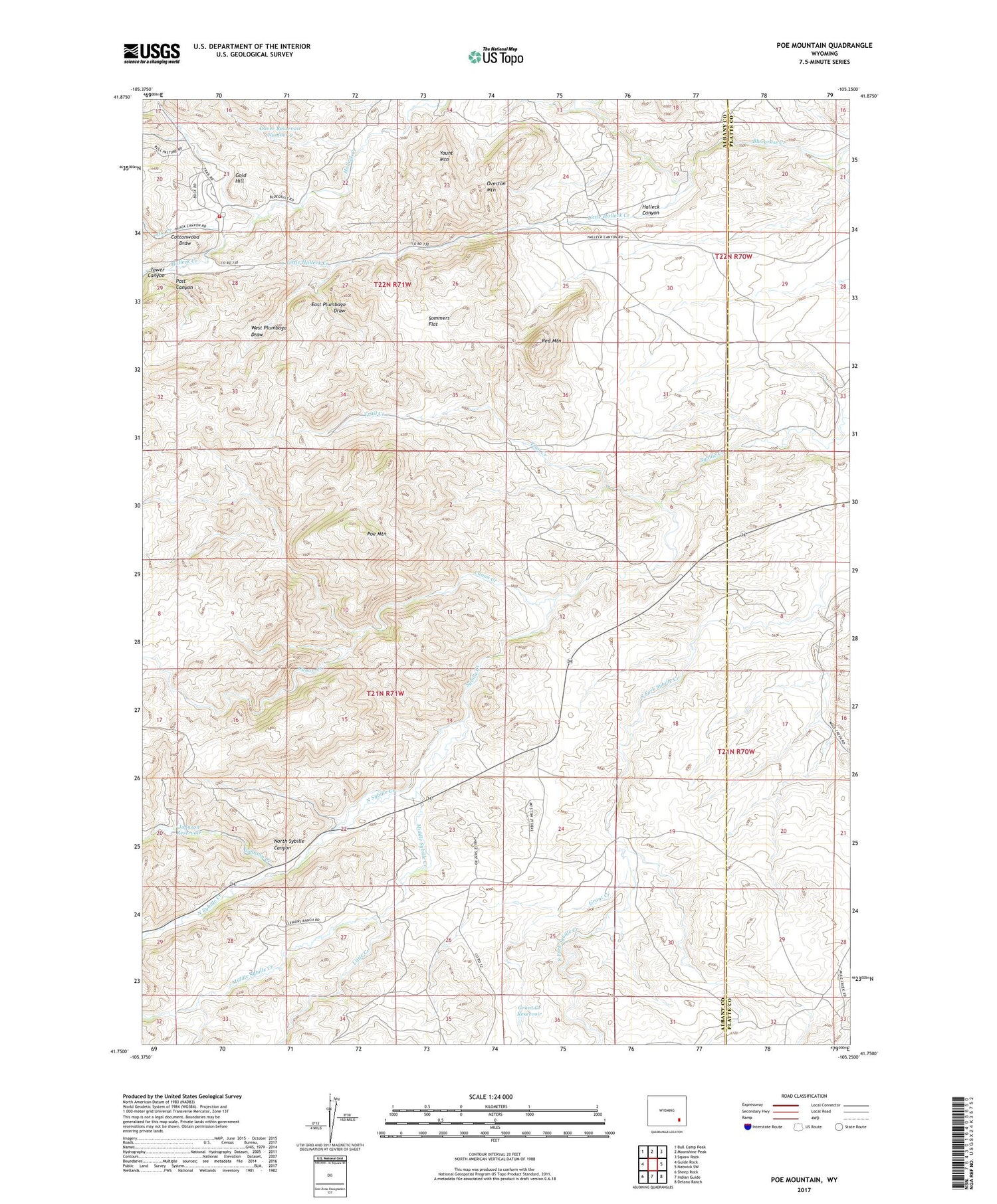
2021 topographic map quadrangle Poe Mountain in the state of Wyoming. Scale: 1:24000. Based on the newly updated USGS 7.5' US Topo map series, this map is in the following counties: Albany, Platte. The map contains contour data, water features, and other items you are used to seeing on USGS maps, but also has updated roads and other features. This is the next generation of topographic maps. Printed on high-quality waterproof paper with UV fade-resistant inks.
Quads adjacent to this one:
West: Guide Rock
Northwest: Bull Camp Peak
North: Moonshine Peak
Northeast: Squaw Rock
East: Natwick SW
Southeast: Delano Ranch
South: Indian Guide
Southwest: Sheep Rock
Contains the following named places: Canon Creek, Canyon Creek, Christiansen Number 2 Dam, Christiansen Number 2 Reservoir, Cobar Number One Mine, Cottonwood Draw, Dover Reservoir Number 2, East Plumbago Draw, Gold Hill, Grant Creek, Grant Creek Dam, Grant Creek Reservoir, Halleck Canyon, Joe Creek, Johnson Creek, Johnson Dam, Johnson Reservoir, Little Creek, Little Halleck Creek, Lucy Ranch, McGill Ranch, Middle Sybille Creek, North Sybille Canyon, North Sybille Creek, Overton Mountain, Poe Mountain, Post Canyon, Red Mountain, Sommers Flat, Sybille Volunteer Fire Department, Tower Canyon, Trail Creek, West Plumbago Draw, Yount Mountain