MyTopo
Squaw Rock Wyoming US Topo Map
Couldn't load pickup availability
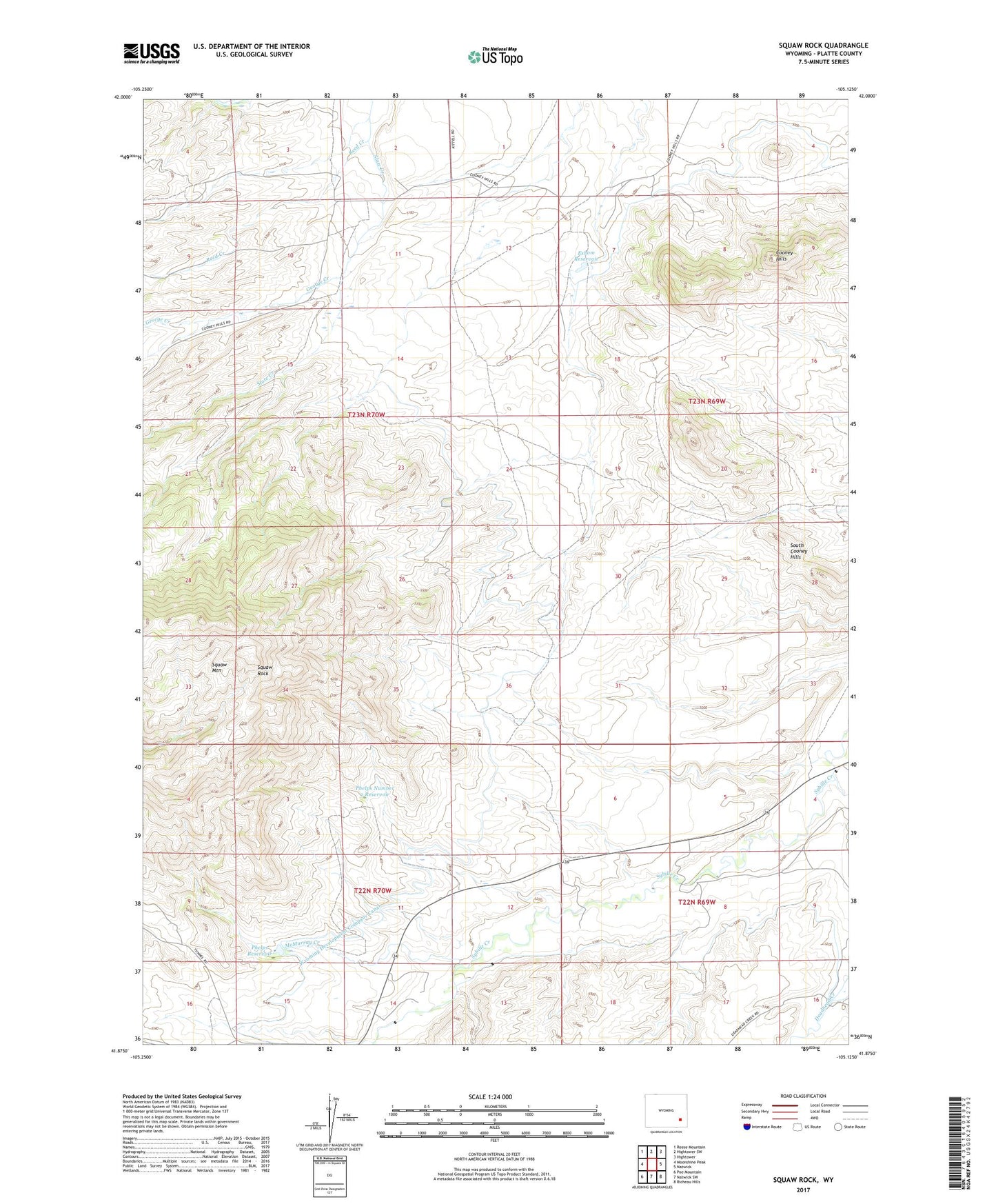
2023 topographic map quadrangle Squaw Rock in the state of Wyoming. Scale: 1:24000. Based on the newly updated USGS 7.5' US Topo map series, this map is in the following counties: Platte. The map contains contour data, water features, and other items you are used to seeing on USGS maps, but also has updated roads and other features. This is the next generation of topographic maps. Printed on high-quality waterproof paper with UV fade-resistant inks.
Quads adjacent to this one:
West: Moonshine Peak
Northwest: Reese Mountain
North: Hightower SW
Northeast: Hightower
East: Natwick
Southeast: Richeau Hills
South: Natwick SW
Southwest: Poe Mountain
This map covers the same area as the classic USGS quad with code o41105h2.
Contains the following named places: Big Mac Claim, Cooney Hill Prospect, Deadhead Creek, Eshom Dam, Eshom Reservoir, Friday Number Two Prospect, George Creek, JBC Deposit Mine, McDougal Deposit, McMurray Creek, Phelps Dam, Phelps Number 2 Dam, Phelps Number 2 Reservoir, Phelps Reservoir, Precious Honor Mine Number 1, Precious Honor Mine Number 2, Reed Creek, Roff Deposit Mine, South Cooney Hills, Squaw Mountain, Squaw Rock, Whipporwill Mine, Wyoming Development Company Canal